|

The Higher Lighthouse
|
|
|
© OpenStreetMap contributors - see http://www.openstreetmap.org/copyright
|
|
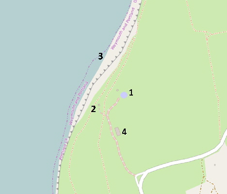
The dominating feature of this part of Portland is the Old Higher Lighthouse which stands high above the cliffs alongside the Coastguard Lookout.
The cliffs here are high and dangerous.
Please click here for a detailed map. The arrow points to the centre of the area described here. Click the BACK button on your browser to return to this page.
Please click here to visit the satellite image of this area on Google Maps. Click the BACK button on your browser to return to this page.
Please click here for many historic pictures of Portland Bill’s three lighthouses. Click the BACK button on your browser to return to this page.
|
Please use this table to navigate around this page
|
|
OLD HIGHER LIGHTHOUSE [1]
|

|
|
MARIE STOPES ON PORTLAND
|

|
|
COASTWATCH LOOKOUT [2]
|

|
|
PORTLAND BUNKHOUSE [4]
|

|
|
CLIFFS [3]
|

|
|
ANOTHER OF MY HOBBIES
|

|
|
OLD HIGHER LIGHTHOUSE [1]
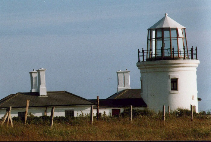
This has undergone extensive changes to the tower since operations started in 1716. It was coal fired until 1788. The Comben family, who ran the lamp from 1716, had to haul the coal across fields from Easton - a terrible task in the winter and not much fun in summertime! Trinity House inspectors sometimes found the light unlit which was unacceptable as the coastline was extremely dangerous to shipping. The lamp was converted to burn oil; the first in the world to be so fitted.
In 1906 the house was sold for £400 and in the 1920s it became the home of Marie Stopes a pioneer of birth control. Pictures of Dr Stopes, her family and distinguished visitors can be seen here. Use your browser BACK button to return here. Some examples are reproduced below.
Marie Stopes lived on Portland in the Higher Lighthouse from 1923 and bought Avice’s Cottage in Wakeham to convert to the Portland Museum which she opened in 1930 - see the museum here.
Click here for details of her extraordinary life and work.
Thomas Hardy and his wife with Marie Stopes outside the Upper Lighthouse in 1923.
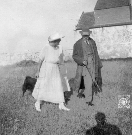
Marie Stopes with Thomas Hardy and her dog ‘Wuffles’ in 1923. Other visitors included George Bernard Shaw and H. G. Wells.
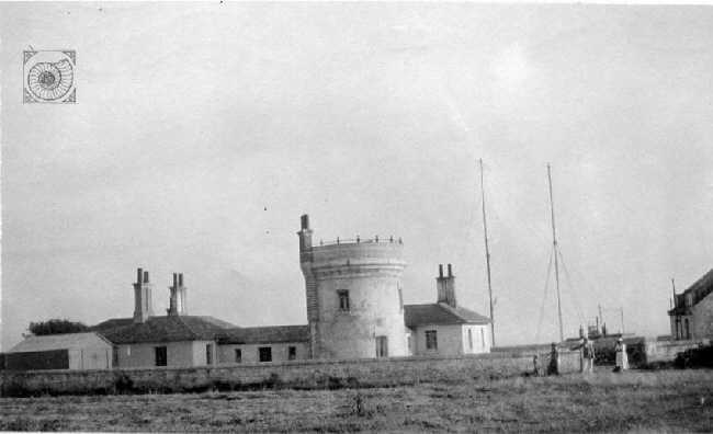
The Higher Lighthouse as it was in the 1920s when Marie Stopes lived there.
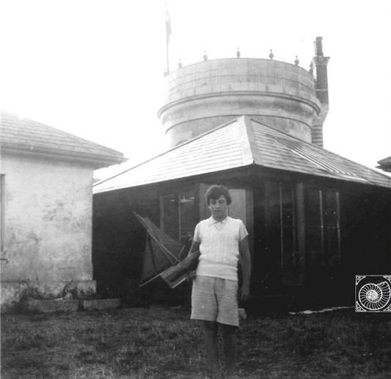
Harry Stopes-Roe outside the lighthouse’s lounge in 1935
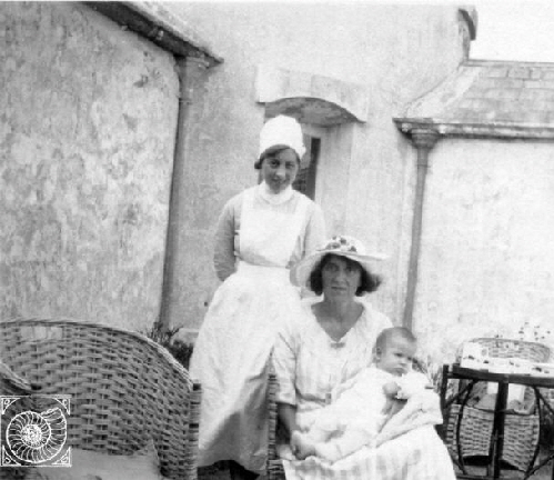
Marie Stopes with Nurse Jones and ‘Buffkins - her pet name for her son Harry Stopes-Roe. Picture taken in September 1924.
In the 1960s the old lighthouse was run as a restaurant and is now a private house - please click here for more details.
The history of this lighthouse as researched by Ashley Smith is summarised here.
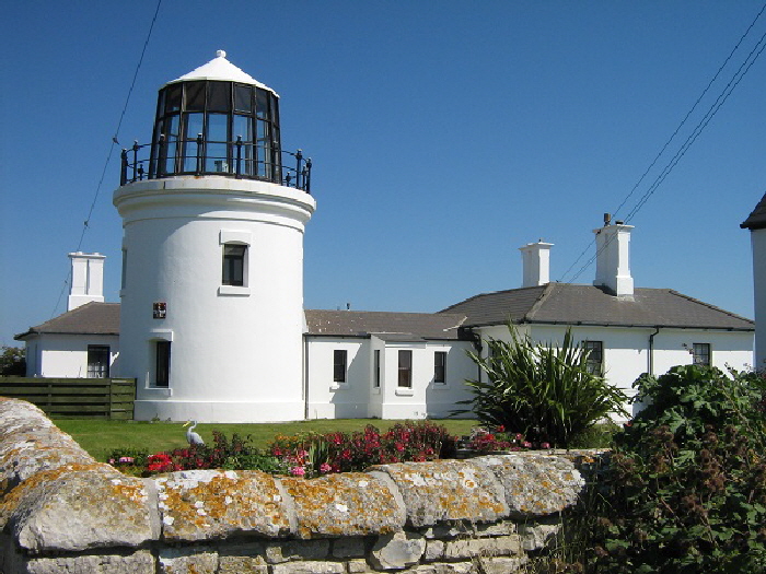
The modern picture above can be compared with the 1920s photograph below from the time when Marie Stopes lived here.
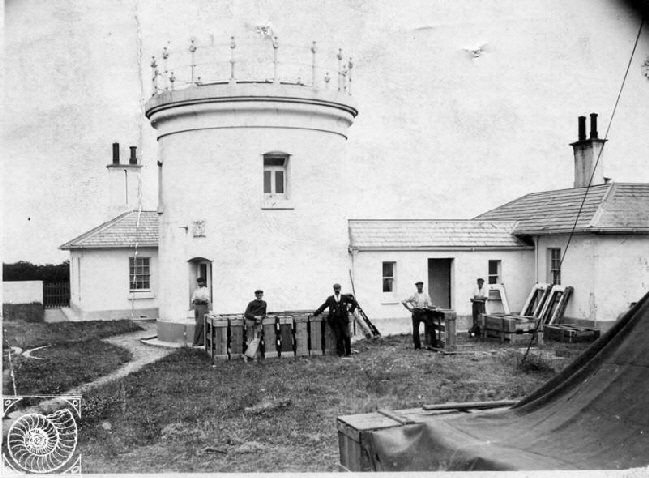
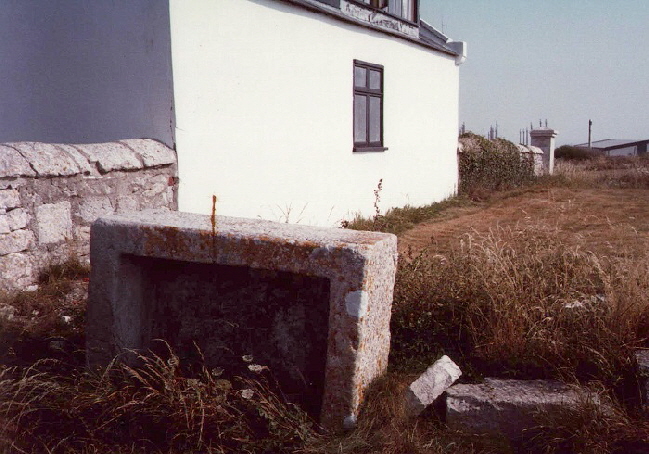
At right we see a Portland stone animal drinking trough tipped over and standing outside the Upper Lighthouse in August 1990 but gone a few years later. Has it survived or been destroyed like so many other ancient troughs?
Return to the top of this page
PORTLAND BILL COASTWATCH LOOKOUT [2]
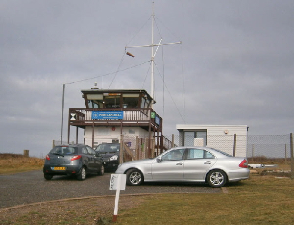
The National Coastwatch Station operates from near the Old Higher Lighthouse - click here for details.
Return to the top of this page
PORTLAND BUNKHOUSE
The “Portland Bunkhouse” occupies a building which was originally a Royal Navy Transmitter Station. The original operations were started on the site in 1904 as the Marconi Transmitter Station. Please click here to read Ashley Smith’s fascinating history of this site.
By the 1960's the site was known was the RN Portland Bill W/T Station. At this time there were two huge aerials nearby and many smaller aerials on the ground adjacent to the building. The ground traces of these aerials can be seen in the Google Earth view here.
In 2008 the building was taken over by a local dive operator for storage and occasional overnight accommodation for divers and in 2012 the current owner took it over and it now operating as The Portland Bunkhouse.
The website is http://www.portlandbunkhouse.com/
Return to the top of this page
CLIFFS [3]
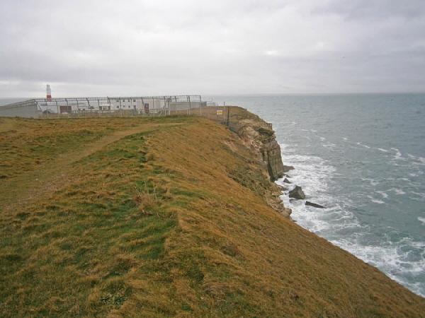
The cliffs in this area fall steeply and from a great height (55 metres) to the sea. It would be all too easy to adventure too close to the edge and slide to one’s death here.
In the grass area this area are two pairs of well worn marker stones as seen below. I have no idea what these once marked.
Until the 1970s two high radio towers stood here. Canvas cones used to be hoisted on one of the towers to warn mariners of impending storms. I could see these from my office window in the early 1970s when I worked at the nearby Admiralty Underwater Weapons Establishment.
This aerial photograph from the 1990s clearly shows the bases of the two large aerials south-west of the transmitting station which is now the Portland Bunkhouse. In October 2016 I carefully walked the area where the aerials once stood but was unable to find any trace of their presence.
What I did find however were many huge ants’ nests which could well have been several hundred years old.
Return to the top of this page
ANOTHER OF MY HOBBIES

Age of 75 I started a new hobby - writing and publishing books. These are available as paperbacks from Amazon - please click here for details. Their overall star rating from readers is 
|