|

Northern Chiswell and Northern Fortuneswell
|
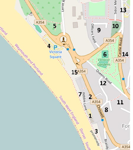
|
|
© OpenStreetMap contributors - see http://www.openstreetmap.org/copyright
|
|
There are many more pictures and stories in the 'Southern Chiswell' page of this website which is reached by clicking on the 'S' arrow above.
Chiswell is an ancient community which has lived on the edge of disaster for centuries.
Since Tudor times, fisherman's houses were built on the shifting stones of the Chesil Bank and these houses were frequently flooded during the powerful gales to which this coast is exposed.
Stuart Morris includes some excellent photographs of these houses and their inhabitants in his book "Portland - An Illustrated History" published by the Dovecote Press in 2016.
To appreciate what it was like living under the threat of the sea in Chiswell do try to get a copy of the book "Big Ope - Little Dreams" by John Matthews published by Artsmiths of Chiswell in 1990. A gem of a book which is so spellbinding that I finished it at one sitting.
By the early 1800s Chiswell was the biggest settlement on Portland. Then, in 1824 a hurricane hit the Dorset coast. Some 80 houses were destroyed, another 100 made uninhabitable and 26 people were killed- the community was destroyed. Most of what you see in Chiswell now are the ruins of a few pre-1824 houses and newer properties.
There are many old pictures of this area to be seen by clicking here. Please click here for a detailed map. Click the BACK button on your browser to return to this page. Please click here to visit the satellite image of this area on Google Maps. Click the BACK button on your browser to return to this page. Please click here to explore this area on Google Street View.
The village of Chesilton - now Chiswell - in 1805. Few of the buildings shown survived the ‘Great Storm’ of November 1824.
|
Please use this table to navigate around this page
|
|
CHISWELL MAIN ROAD - SOUTHERN PART
|

|
|
CONJURERS LODGE [8]
|

|
|
“THE OPES” [2]
|

|
|
CHISWELL COMMUNITY GARDEN [2]
|

|
|
CHISWELL MAIN ROAD - NORTHERN PART
|

|
|
‘DAP AND GENERAL’ STORIES
|

|
|
LORD CLYDE CAR-PARK [15]
|

|
|
THE LITTLE SHIP PUB [15]
|

|
|
WESTERN SIDE OF VICTORIA SQUARE
|

|
|
SEA GULL SANCTUARY [5]
|

|
|
VICTORIA SQUARE RAILWAY STATION [5]
|

|
|
EASTERN SIDE OF VICTORIA SQUARE [4]
|

|
|
VICTORIA GARDENS [6]
|

|
|
FLOODS
|

|
|
PEBBLE LANE [7]
|

|
|
RANTERS LODGE AND THE DEAD HOUSE [1]
|

|
|
THE COVE HOUSE INN [1]
|

|
|
OFFICERS’ FIELD [9]
|

|
|
THE STRANGERS’ CEMETERY [10]
|

|
|
OUTLOOKS CENTRE [13]
|

|
|
OLD POLICE STATION [14]
|

|
|
HIGHER LANE [11]
|

|
|
QUEENS ROAD [12]
|

|
|
CLEMENT’S LANE [11]
|

|
|
ANOTHER OF MY HOBBIES
|

|
|
Chiswell and Victoria Square viewed from the top of Portland in November 1989 with the annual funfair in full swing.
The main street running through Chiswell is mostly an uninspiring collection of bland modern housing with a few older buildings. Little of any architectural interest survived the “Great Storm” of November 1824. With flooding a frequent experience since then Chiswell has not attracted either interesting dwellings nor the people to invest money in the area.
If you don’t believe me take the Google Streetview tour - click here to start.
There is a pleasant Community Walled Garden created on the site of what were, in the 1970s, the smelliest and most disgusting public toilets in Dorset. Although the sign by the door states that the garden is open every day during the hours of daylight it has always been locked up when I visit.
I will start our tour of Chiswell at the southern end and head north. We will then look at the lanes and tracks which run off the main road towards the Chesil Beach and towards the steep housing area of Northern Fortuneswell.
![]() Return To Top Of Page Return To Top Of Page
CHISWELL MAIN ROAD - SOUTHERN PART
This is the view north from the bottom of the hill. Chiswell is about three metres above sea level which is why it has suffered such devastating floods over many centuries. The Chesil Beach lies on the left and the Esplanade which protects the village from all but the worst storms can be glimpsed where the white boat is perched upon the beach’s crest.
The picture below shows much the same viewpoint from a century earlier. The small stone structure was the village water supply and it stood where the white van is parked in the picture above.
Another old view north along Chiswell main street. The water supply well is at centre. The building on the left of this old photograph still stands as seen below. The “King’s Arms” pub is on the right with the front extension. This building remains today - slightly altered - as a private house. However, the pub sign on the front wall has been retained and proudly repainted recently as seen below.
On the beach side of Chiswell is an old chapel. The building is next to an undeveloped area of waste land. However, the picture below shows that a fine house once stood here as well as long-gone houses built up to the crest of the beach.
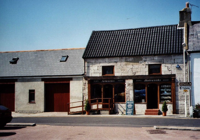
An excellent conversion of a fisherman’s cottage into a double fronted shop. Photographed in August 2002.
Above - a block of apartments under construction in 1990 adjacent to “Big Ope” leading up to the Cove House Inn.
Below - the final result photographed in 2002. A suitable replacement for derelict shops and cottages.

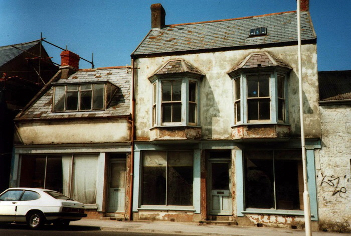
The houses and shops in Chiswell have experienced many changes of ownership over the years. In some cases they changed use but others were demolished and replaced.
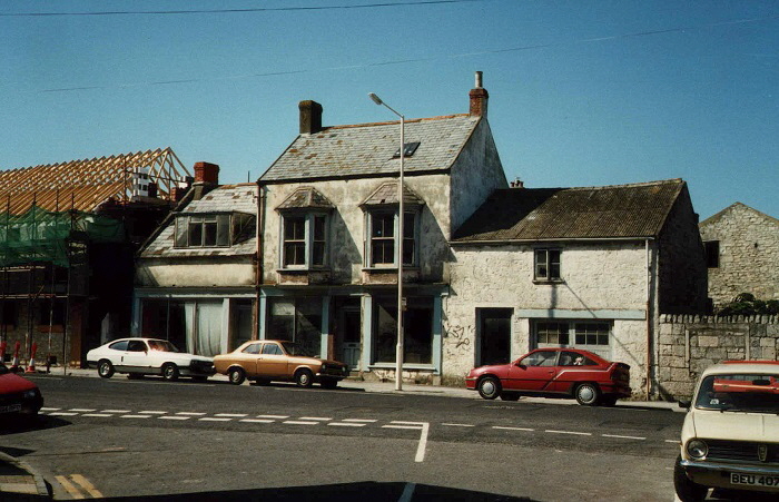
The derelict buildings above were demolished to make way for the new housing shown below.
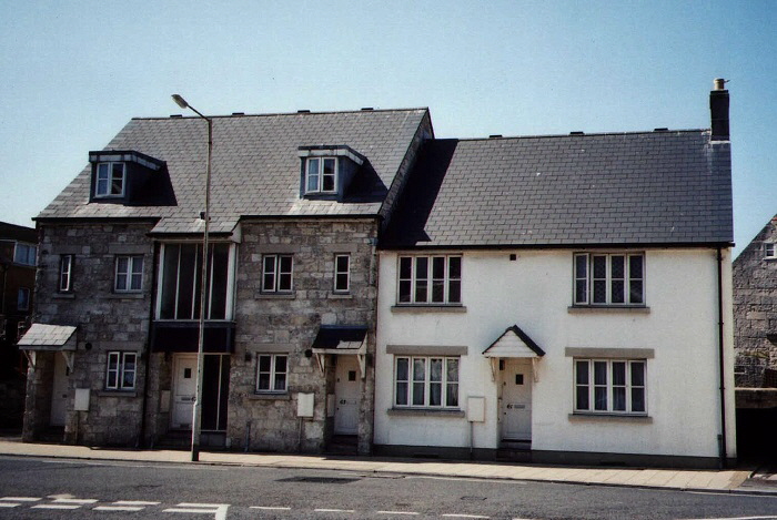

Further development underway on the eastern side of the main road of Chiswell in 1989. Gradually the length of Chiswell changed as the old - and mostly derelict - houses and shops were renovated or replaced in the 1990s.

The Beach House Hotel - please click here for the hotel’s website
A similar view to the one above but from the southern end of Chiswell. This picture was probably taken in the early 1900s.
![]() Return To Top Of Page Return To Top Of Page
CONJURERS’ LODGE. [8]
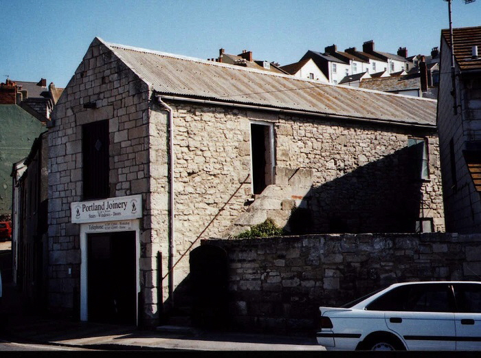
Conjurers’ Lodge was set up in 1816 when the Rev. Francis Derry came to Portland to investigate stories that the local Methodists were believers in witchcraft. Fifty of the Portland flock were expelled from the church. They worshipped in the upper floor of Conjurers’ Lodge for ten years until they were assimilated back into the conformist congregation. An excellent article on Conjurers’ Lodge can be read here.
On the opposite side of the main road close to The Cove House Inn was Ranters’ Lodge and The Dead House - please click here to see a picture.
One might gain the impression that there was a great religious fervour and many sectarian schisms on Portland in Victorian times and this seems to have been be largely true although contemporary accounts seem to divide the population up between the hysterically religious and the ‘no nonsense’ pragmatic doubters.
Certainly Methodism played a large role in Portland society after Charles Wesley preached on the Isle in June 1746. There is a detailed history of religion on Portland to be seen here and Stuart Morris has contributed to this history here.
![]() Return To Top Of Page Return To Top Of Page
THE OPES [2]
Chiswell has several “Opes” leading from the western side of the main street up towards Chesil Beach. Ope means an ‘opening’ or a passageway allowing the residents of Chiswell to access the beach. Over the centuries the ‘Opes’ have come and gone. Some were large enough to have cottages on either side to form a short ‘street’ whilst others were so narrow that two fisherman could scarcely pass each other.
In the 1880s there were three Opes. “Big Ope”, “Little Ope” and “Dark Ope”.
Eric Rickets (“The Building of Old Portland”) gives a detailed sketch of the cottages on the western side of Chiswell at that date and compares this with a modern scene.
“Big Ope” runs now, as then, up to the Cove House Inn. This has cottages on both sides so lives up to its name.
“Little Ope” is now called “Lerrett Ope” to remember the double-ended rowing boats used on Chesil Beach. A picture of a Lerrett can be seen here. This Ope runs up to the Chesil Beach alongside the Community Garden.
“Dark Ope” was a covered passage through a cottage which has long been demolished. At about the same location is a very narrow uncovered passage called - amusingly - “No Ope”.
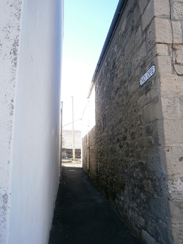
“No Ope”
![]() Return To Top Of Page Return To Top Of Page
CHISWELL COMMUNITY GARDEN [2]
The Community Garden in Chiswell was created out of the ruins of probably the smelliest and most disgusting public toilets in the country and I should know because I was forced to use them on several occasions whilst visiting Portland’s Fair in the 1960s. Before the toilets were built this site was occupied by a pair of 17th century cottages which were destroyed by gigantic waves which crashed over Chesil Beach in November 1824.
The walled garden in now located on the site of the cottages on the far right of the above picture from 1805.
There is an informative article about the walled garden which can be read here.

The above picture was taken in July 2006 and shows the work in progress on the garden. The following three pictures of the Community Garden were taken in January 2010

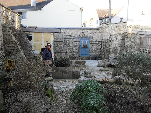
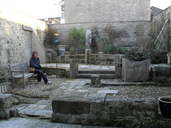
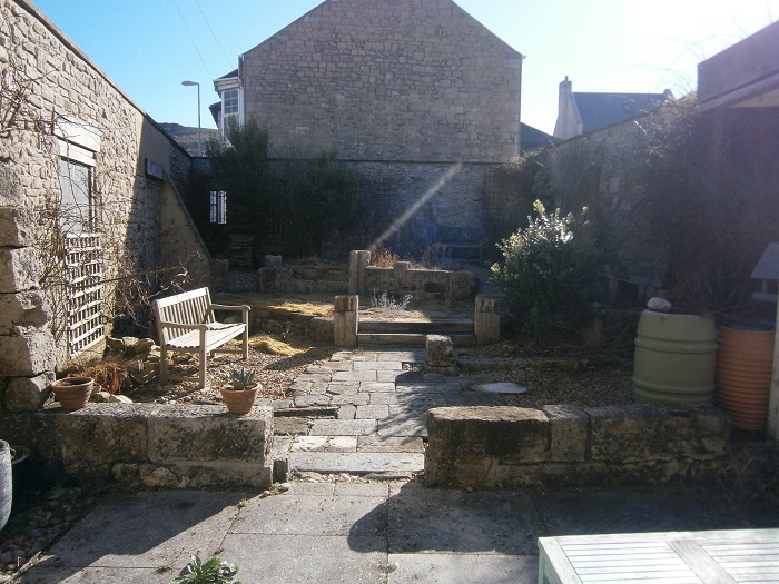
This picture was taken through a hole in the locked door in February 2015. Little appears to have changed for better or worse over the intervening five years.

![]() Return To Top Of Page Return To Top Of Page
CHISWELL MAIN ROAD - NORTHERN PART
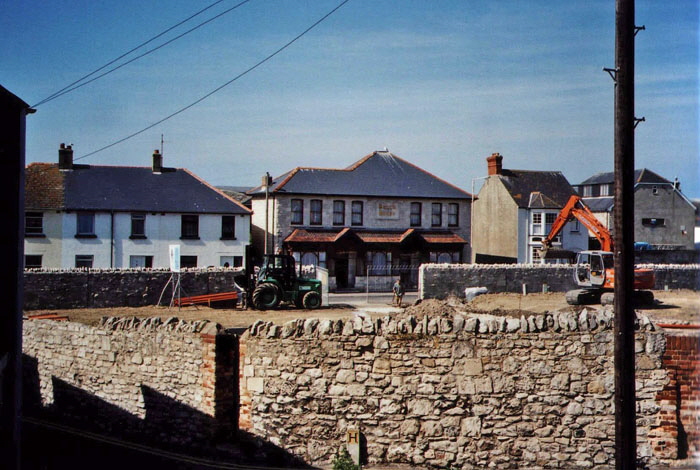
The above picture from September 2002 is looking over “Baker's Ground” as it was being cleared for houses to be built and the houses are completed in the lower picture.
According to a letter in the Free Portland News in 2010, the large area of Baker’s Ground was a builders yard in Victorian times. The old picture below shows the clearing up after a flood and a large overhead travelling crane set up in Bakers Ground.
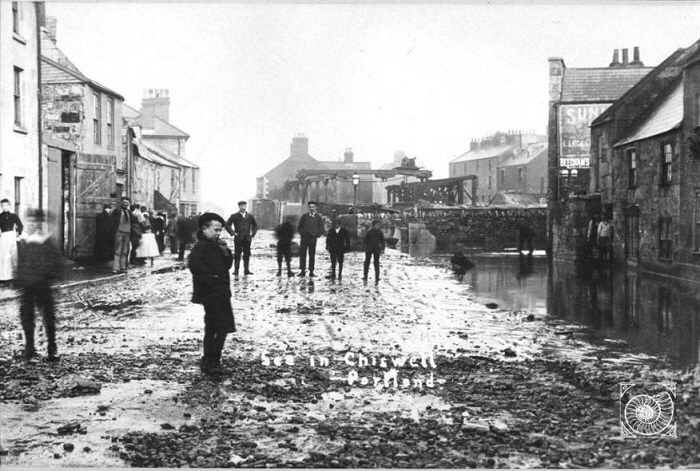
The land was bought by John and Ann Orton who travelled around the country with horses and caravans seemingly trying their hand at many pursuits. They set up a a theatre on Baker’s Ground in the early part of the 20th century and put on plays with music and 'magic lantern' shows. They later erected a red brick building to show films which were a great novelty on Portland. The land then lay unused except for the annual Portland Fair every November when it was packed with fairground rides until it was built upon late in the 20th century.
DAP AND GENERAL
The restaurant shown above stands on the corner of Chiswell and Pebble Lane. In the late 1980s it was named "The Dap and General" after two Portland brothers who lived in the first half of the 20th century.
They have been depicted as the Laurel and Hardy of the Royal Manor and very many stories have been recorded in the Free Portland News over the years. Some of these stories have been gathered together into a book "It Could Only Happen on Portland" published by Artsmiths of Chiswell.
It seems that Dap was a great admirer of Doctor Howard who rode an old motorcycle to get around Portland and wore a reversed cap. Dap thought this looked wonderful so went to a gents' outfitter for a cap. Having tried on everything in the shop without success the frustrated shopkeeper asked Dap just what sort of cap he wanted.
"None of these. I want one like the doctor’s with the peak at the back!"
Another story tells how Dap and General went to London for the day on the train; their first trip off Portland. On returning home they told their friends how wonderful London was. It was all covered over with a huge glass roof to keep the rain out!
It was eventually realised that they had stayed in Waterloo station all day believing that was all there was of London.
A third story tells how the brothers found a huge wooden beam on Chesil Beach. They struggled to carry it but it was too heavy. Dap went home and eventually appeared with a saw. He cut the beam into halves and the brothers each carried half the beam home.
“That was so much easier!” declared Dap!
‘Dap and General’ were actually HENRY LANO BYATT (DAP) born 1858 in Kent and died at 90 Chiswell in 1928. WILLIAM THOMAS BYATT (General) was born 1866 in Kent. The brothers moved to Portland to be with their sister who is shown below.
DAP is the shorter of the two men shown above outside The Cove House Inn.
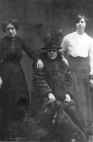
The lady seated is Mary Emma Byatt the sister of Dap and General.
Return To Top Of Page
LORD CLYDE CAR-PARK [15]
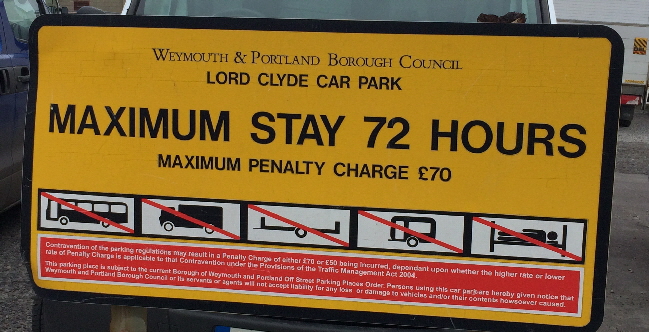
Between the Blue Fish Cafe and The Little Ship pub is an area of waste ground called the Lord Clyde car-park. So who or what was Lord Clyde?
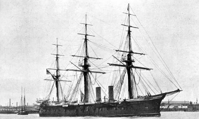
On the site of this car-park was once a pub named “The Lord Clyde” and that was named after the battleship of that name illustrated above. Only two ships in this class were built in the 1860s. HMS Lord Clyde and her sister ship, Lord Warden, were the heaviest wooden ships ever built and were also the fastest steaming wooden ships. It could steam at 13 knots and held a crew of 605 men in total.
HMS Lord Clyde was initially assigned to the Channel Fleet in 1866, but was transferred to the Mediterranean Fleet in 1868. The ship suffered engine problems throughout her career and the engine needed to be replaced after only two years of service. She rejoined the Mediterranean Fleet in 1871, but was badly damaged when she ran aground the next year. When Lord Clyde was under repair, her hull was found to be rotten and she was sold for scrap in 1875
![]() Return To Top Of Page Return To Top Of Page
THE LITTLE SHIP INN
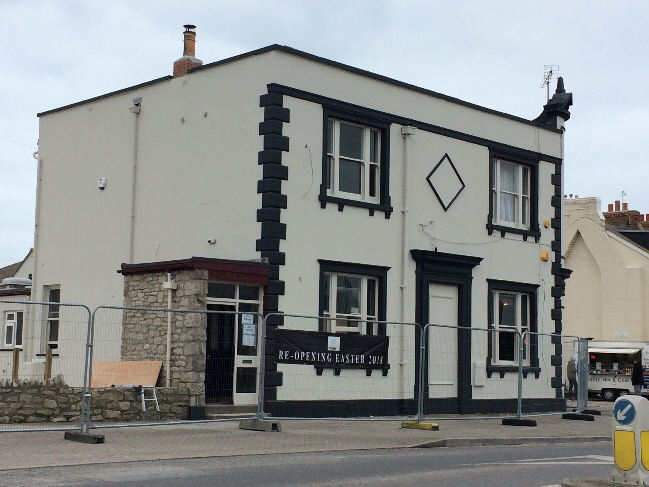
The Little Ship undergoing renovation and about to re-open in March 2018.
WESTERN SIDE OF VICTORIA SQUARE
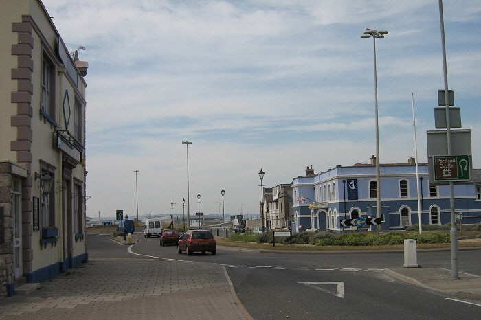
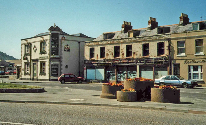
We now move onwards to Victoria Square - which is not actually square! On the left we see the Little Ship Inn which is a listed building.
The Little Ship Inn stands at the southern end of a long block of premises - mainly commercial. The block with blanked out windows in the picture below belonged to Chesil Beach Motors and was their showroom. However, a huge storm wrecked their premises - and a large number of customers' cars - so new premises were bought on Tophill well above sea level - and this block was demolished.
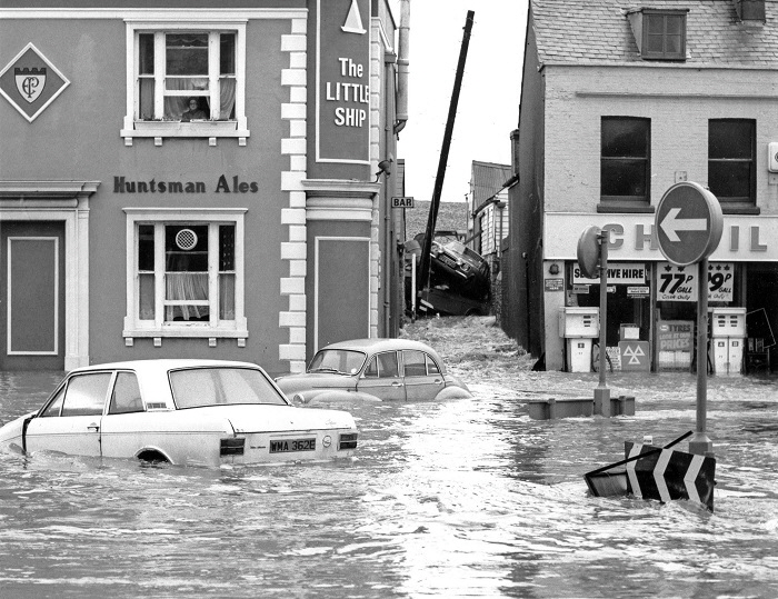
Customers’ cars piled up and wrecked at Chesil Beach Motors premises in 1978.
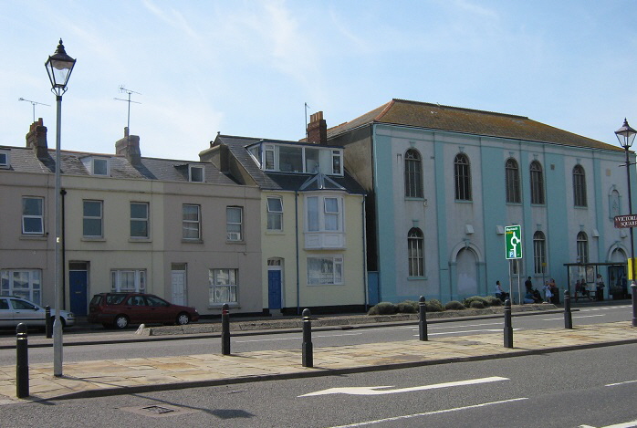
The square is dominated by two large buildings; the Masonic Hall on the west side and the closed Royal Victoria Hotel (later “Masons and Mariners”) on the east; both of which are listed buildings.

“The Royal Victoria Hotel” in 1989
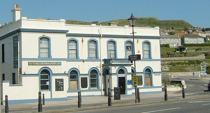
The last days as the “Royal Victoria Hotel”. Picture taken in June 2003

Reincarnated as “Masons and Mariners”
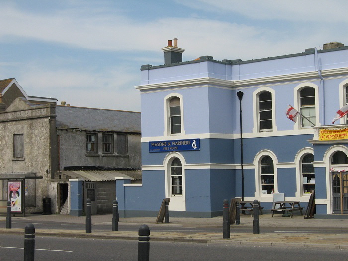
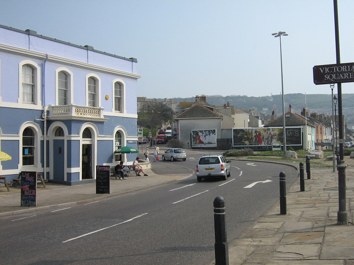
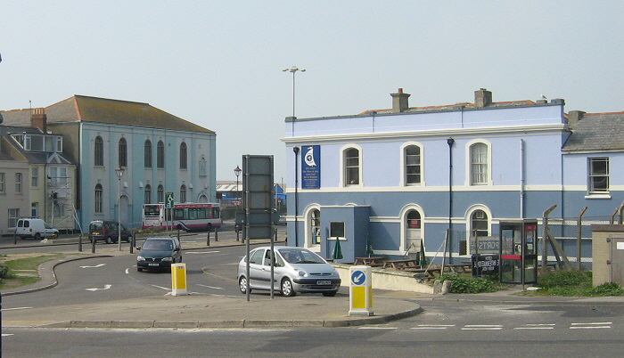
The Masonic Hall is the ugly Victorian slab of a building in the centre of the picture.
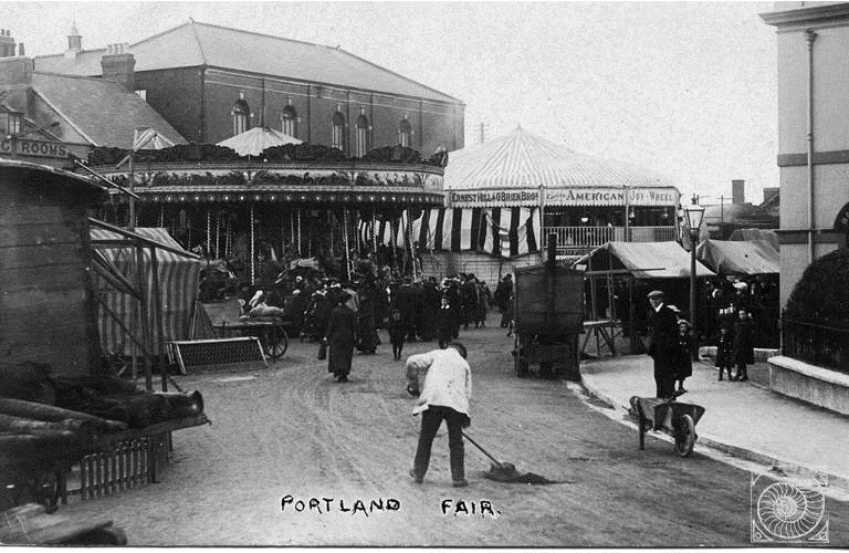
This picture from the early 20th century shows Portland Fair in action. Comparing this view with the previous one is appears as though the single main road to the mainland is completely blocked by the fair. Was this possible?
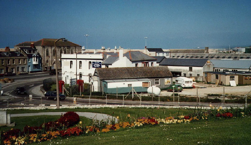
The view in 1989 across Victoria Gardens to the Royal Victoria Hotel which was partly hidden behind the dilapidated and later demolished hut used as a place of worship in this 1989 photograph. I think it may have been used as a scout hut at some time.
A later panoramic view showing the ramshackle building cleared away and the skyline of roofs changed somewhat.
![]() Return To Top Of Page Return To Top Of Page
PORTLAND'S MILLENNIUM SEAGULL SANCTUARY [5]
To the north of the Victoria Square roundabout is a large area of grassed land. On this expanse are two Portland Stone pillars.
Although originally described as a 'Gateway to Portland', years of wrangling resulted in the pillars being erected a very long way from Ferrybridge where Portland and Weymouth meet and long after the Millennium had passed so this cannot be the true reason for these pillars. In fact, the secret is out - the pillars are secure nesting sites where seagulls will not be disturbed at breeding time.
Seagulls (Herring Gulls) are an endangered species on the RSPB's Red List. The RSPB website states
“Seagulls - the generic term for some of the gulls found in the UK - are struggling. The most well-known and most belligerent of all our gulls, the herring gull, is now a red listed species of conservation concern.”
This will amaze residents of Portland, Wyke Regis and Weymouth who are plagued by these aggressive birds attacking people and rubbish bags. Never-the-less, seagulls are endangered birds and must be nurtured and encouraged to breed.
The pair of decorative pillars were, in fact, erected to provide seagulls with ideal vantage points in which to nest safe from predators.
The above photograph shows the official opening of the monumental bird nest sanctuary in the presence of the Mayors of Weymouth and Portland, various dignitaries and my wife and I on 12th June 2004 .
Why where we there? Well, a copy of this website was placed in a time capsule and deposited under one of the pillars on 9th May 2004. In return for this honour Sandy and I wore our smart clothes to enjoy a very good meal provided by the Portland Freemasons.
The photograph below shows the ceremony and is provided by kind permission of Mr Ken Howes Information Officer for the Provincial Grand Lodge of Dorset.
Unfortunately after scarcely ten years the inscriptions have become unreadable. I have heard rumours that French stone was used and not Portland Stone which explains the disgraceful erosion of the surfaces.
![]() Return To Top Of Page Return To Top Of Page
DEMOLISHED RAILWAY STATION [5]
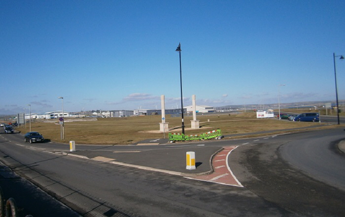
Until the 1970s a wonderful railway station stood in the centre of this view as seen below.

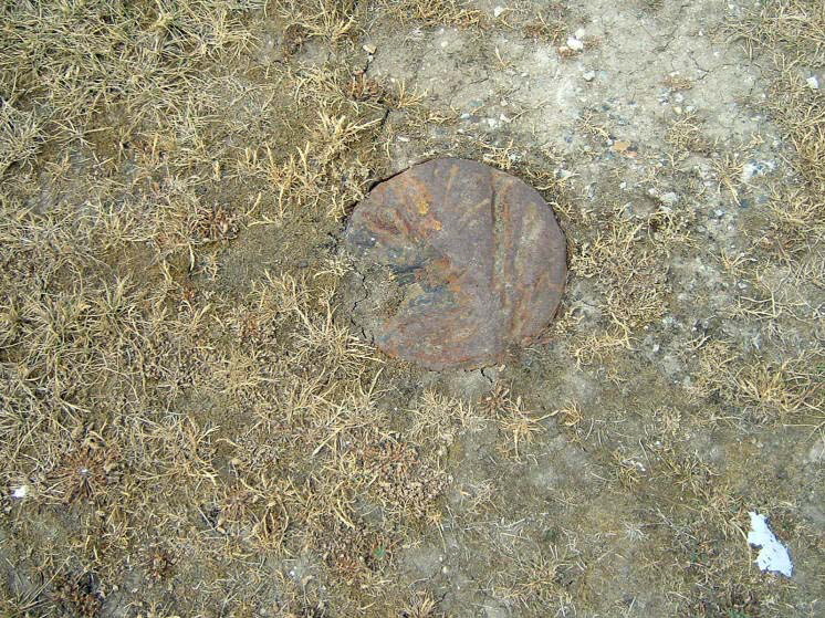
This railway station once stood near the site of the two Portland stone pillars. I remember seeing it standing just to the north of Victoria Square in the 1960s but there is no sign of its existence now except perhaps for the sawn-off steel beam I discovered near the seagull sanctuary pillars in 2004 as shown below.
In fact, this whole area was a huge collection of railway sidings, a station and the main line to Easton as shown in the picture below.

This view is looking south over the area which is now all grass towards Victoria Square. There are many old pictures of Portland’s railway system here and a large scale Victorian map showing the rail network at Chiswell here.
EASTERN SIDE OF VICTORIA SQUARE

I was fortunate to be on the very last passenger train to run on 26 March 1965. In fact the demand for places was so great that there were four ‘last trains’ but I was on the real last one to run. This gave me the opportunity to spend the morning rushing around Portland photographing the earlier trains before embarking on the last of the last trains.
I well remember the train briefly stopping at the station at Chiswell before starting the long climb through the Royal Naval Dockyard towards Easton.
Stuart Morris has written about a dip in the crest of the Chesil Beach near the Masonic Hall as follows:
“After the arrival of the railway in 1865 (initially to Victoria Square only) visitors would flock to see the sea and climbed over Chesil Beach near what is now the Masonic Hall. So many feet trampled the shingle there that it caused a hollow in the crest, which the locals called Station Hollow. Fishermen used it as a reference point.”
A small industrial area north of Victoria Square.
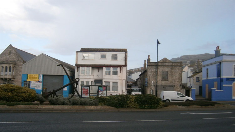
On this unlikely site once stood an astronomical observatory as seen below.
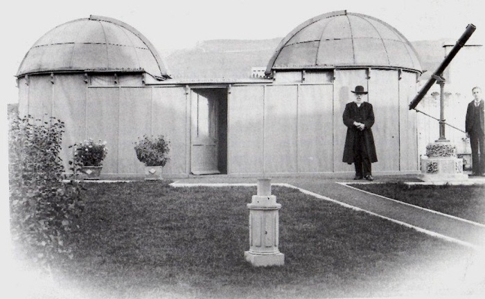
This observatory was set up adjacent to the Victoria Square gas works in mid-Victorian times. It was built and used by Rev. William Robert Morris Waugh (1818 - 1906) who was famous for his detailed observations of the cloud structures on the planet Jupiter. An interesting letter about this observatory appeared in the Free Portland News for September 1989.
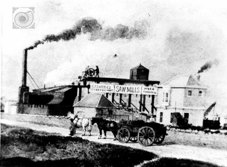
The area around the observatory in mid-Victorian times

Portland’s Sewerage Pumping Works. Until relatively recent times all Portland’s sewerage was pumped straight into the sea. Now it is collected through huge pipes and gathered here for further pumping to the Wyke Regis sewerage station.
![]() Return To Top Of Page Return To Top Of Page
VICTORIA GARDENS [6]
Please click here for some old pictures of Victoria Gardens. There is an informative article by Ashley Smith about the history of Victoria Gardens which can be read here.
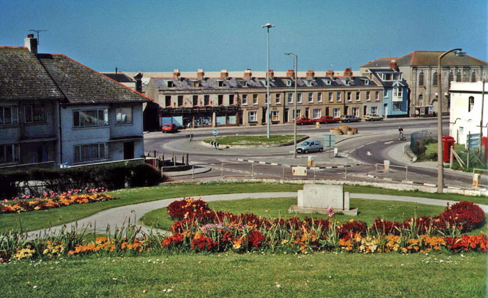
This view from Victoria Gardens across Victoria Square was taken in the late 1980s. The car showrooms can be seen facing the grassed roundabout. This end of the terraced block was demolished soon after this picture was taken.
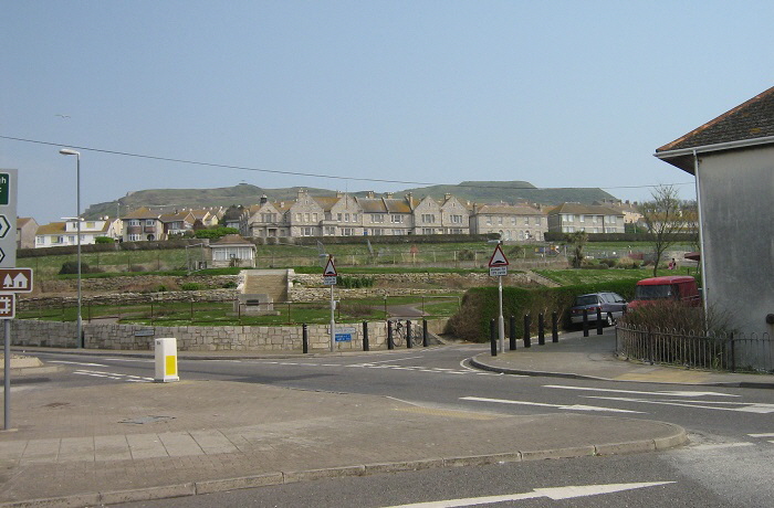
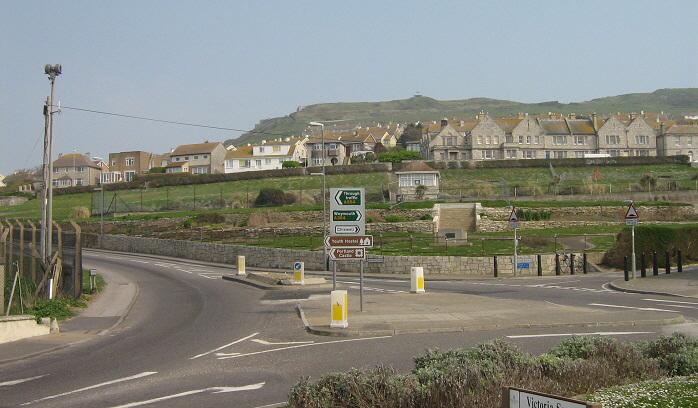
The above picture is from April 2007. The similar view below shows the addition of a clutter of road signs which has not enhanced the attraction of the gardens.
Fortunately, in 2014 a scheme was started to rebuild ornamental gates and an entrance at this point which was a great improvement.
This picture shows ‘work in progress’ in February 2015.
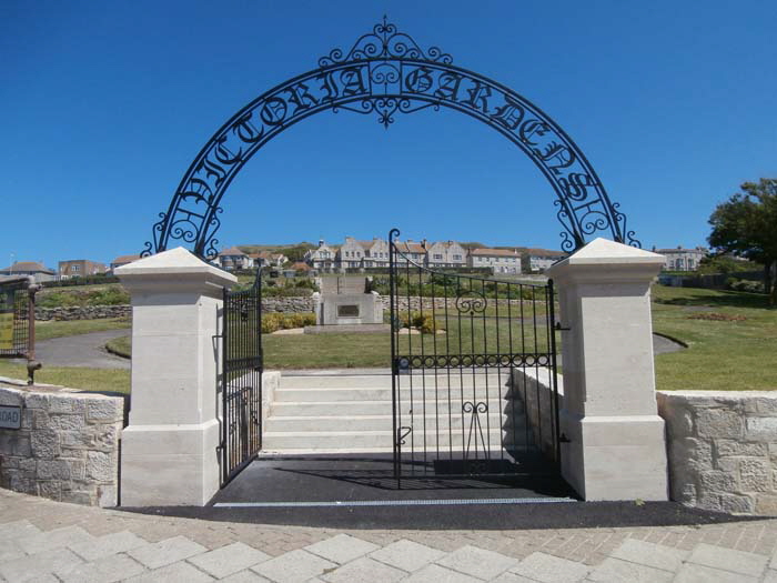
This is the final form of this memorial entrance - a brilliantly executed version of the original.
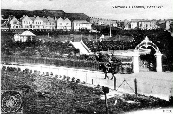
The pictures above and below from Victorian times shows how the entrance to Victoria Gardens was attractive.

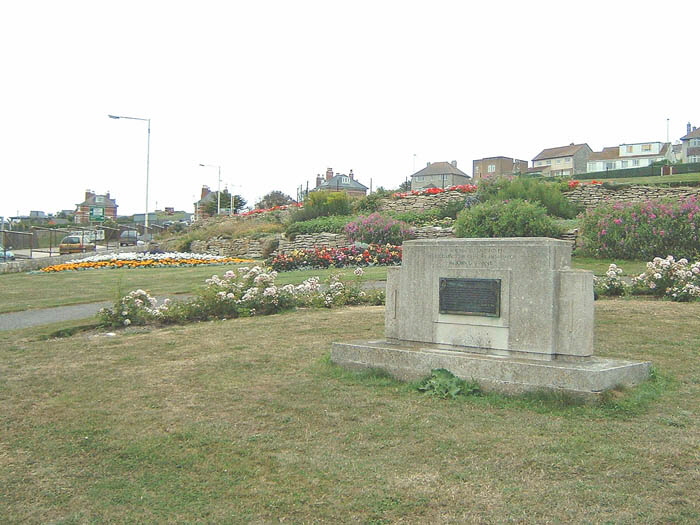
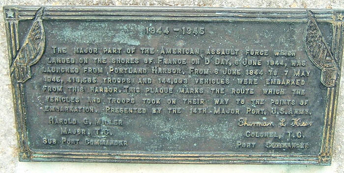
The memorial stone commemorating the D-Day landings in which Portland played a vital role.

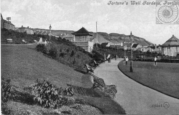
Below we see a similar scene to the above.

The crowds have gathered to celebrate the opening of the gardens in 1904.
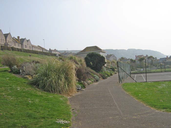
A century separates the modern picture above with the one below.
A bowling green is also located in the centre of the park. The Portland Victoria Bowls Club operate the daily management of the bowling green, however two rinks are available for use by the public for an hourly rate. In July 2011, the club celebrated their 100th anniversary.
![]() Return To Top Of Page Return To Top Of Page
FLOODS
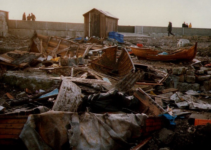
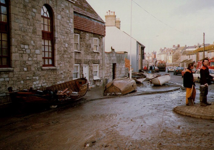
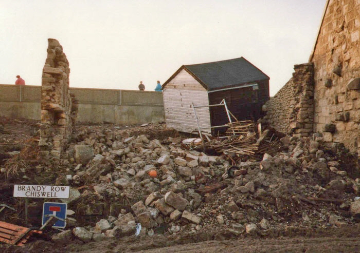
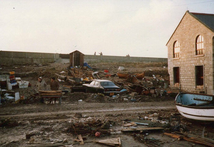
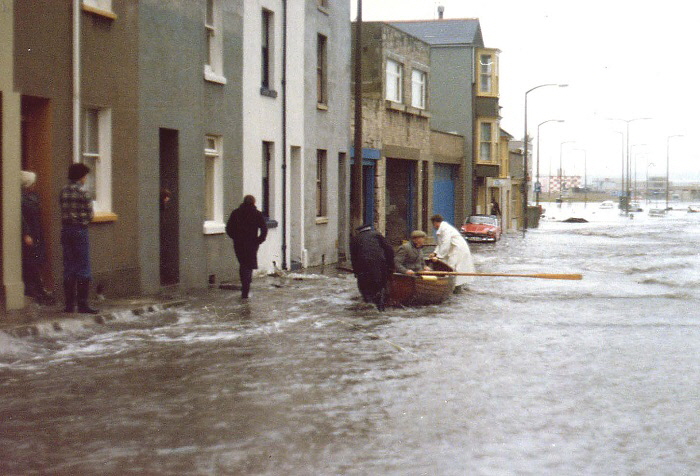
The following pictures of the storm of 13th February 1979 were kindly provided by my friend Alison Holmes' parents

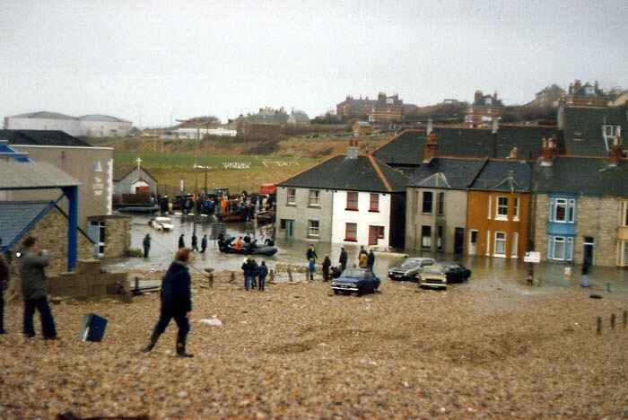
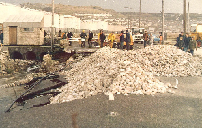
The road to the mainland was closed for four days when the road was swept away. Subsequently the entire main road past the oil storage tanks was raised about a metre.
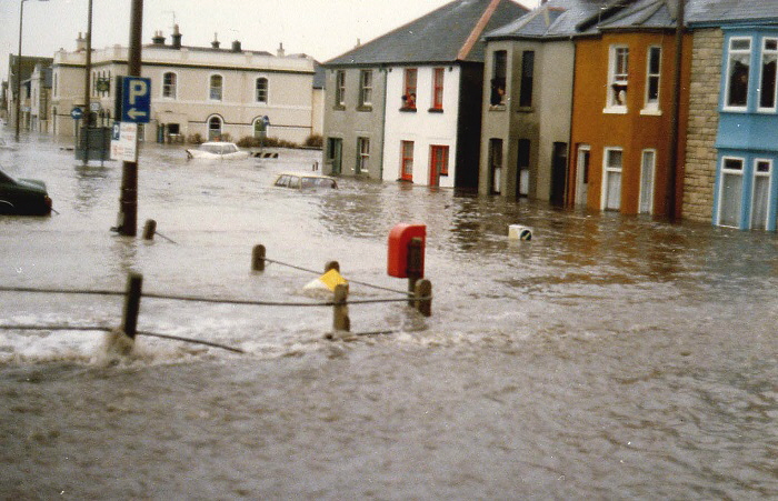
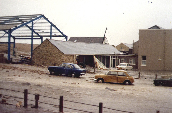


![]() Return To Top Of Page Return To Top Of Page
PEBBLE LANE [7]
Pebble Lane is very aptly named. It is a pebble strewn track from Victoria Square to The Cove House Inn.

Pebble Lane can be seen running up towards the Cove House Inn on the right of this picture.

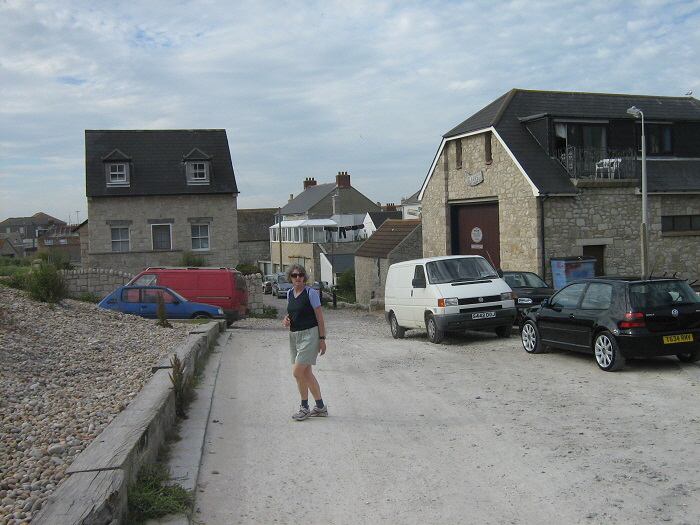

The picture taken in February 2015 looking north down Pebble Lane shows the close proximity of Chesil Beach to the lane. Imagine during a storm seeing the waves and pebbles pouring violently over the beach crest on the left.

This new house being built in Pebble Lane.
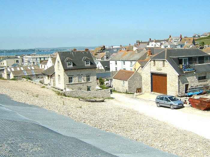
The house completed as seen from the crest of Chesil Beach on top of the stabilising steel mesh.

Above we see one of many old fisherman’s buildings.
![]() Return To Top Of Page Return To Top Of Page
RANTERS LODGE AND THE DEAD HOUSE [1]

On the left is ‘Ranter’s Lodge’ and on the right is ‘The Dead House’. Ranter’s Lodge has been extensively refurbished internally and is rented out - see the website here. The very interesting history of these two buildings is described here.
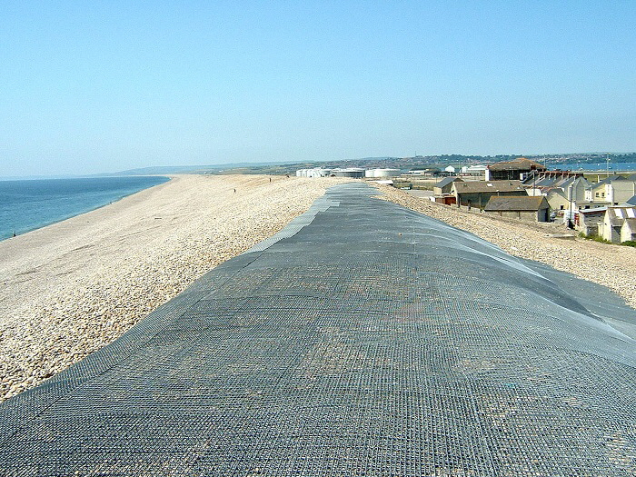
An attempt to stabilise the crest of Chesil Beach above Pebble Lane. The storm of January 2014 still managed to cause severe damage and spectacular waves broke over the beach at this point.
![]() Return To Top Of Page Return To Top Of Page
THE COVE HOUSE INN [1]
This pub must exist at one of the most precarious locations in the UK. The history of this early Victorian building can be read here and the pub’s website can be viewed here.
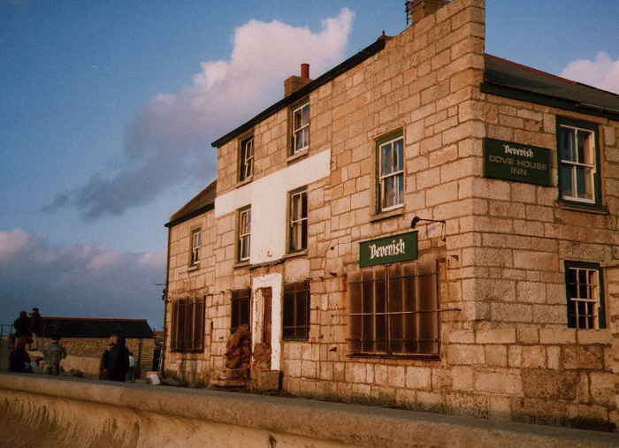
Here we see the Cove House Inn stands rather forlornly after a violent storm of January 1990. The windows are covered with rusty grills and the name board has been lost from the front of the building. There was no porch at that time and in past storms the sea had smashed open the door and roared into the bar as well as tossing pebbles onto the roof. It is difficult to imagine on a calm day just how violent the sea can be at this point.
Please click here and here for pictures taken during the storm of January 2014. Now look at the calm sea below photographed in February 2015. In February 2014 then Prime Minister David Cameron visited Chesil to assess the storm damage and visited The Cove House Inn.
Below we see an old view of this pub. Notice how it then stood on the shingle with no protection from the sea.
![]() Return To Top Of Page Return To Top Of Page
OFFICERS’ FIELD [9]
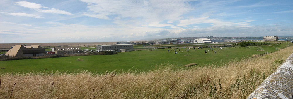
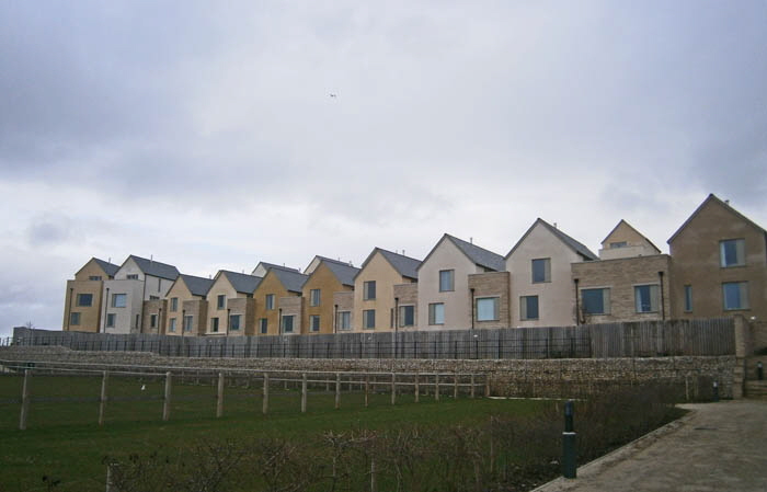
The "Officers Field" seen above used to be a open area for use by the Royal Navy and also by locals for recreation. It was a valuable asset for Underhill, not only for its use in the local community but as an open space giving views out over Chesil Beach.
The above picture was taken just before it was destroyed to build a huge housing estate to accommodate Olympic sailing competitors in 2012. In February 2008 the Planning Application was published to turn this area into housing. The progress on this development is documented below.
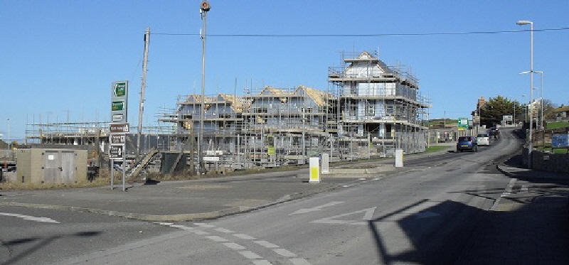
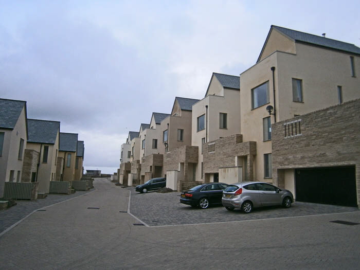
Locals quickly discovered what a blight this development was going to be when one of the tallest properties was built right next to the main road. Who ever thought that was a sensible design?
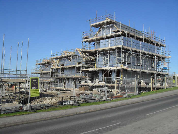
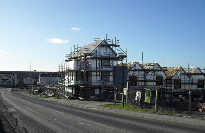

The cramming of a huge number of tiny apartments into a small space was essential to accommodate the Olympic sailing teams but what a grey boring eyesore was emerging!
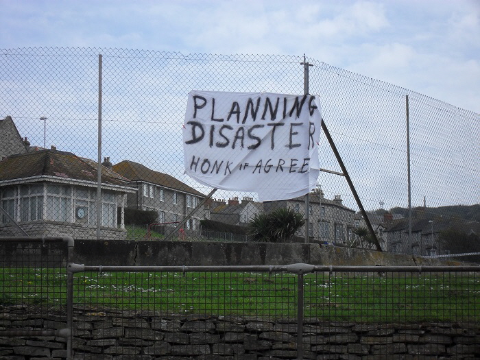
At least one local resident had a firm opinion on this development! Judging by the number of car horns blasting out when I visited in May 2010 a large number of people felt the same!
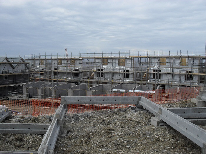
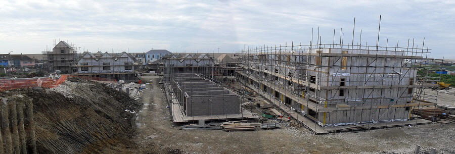
The estate was completed in time for the 2012 Olympics and did not look quite as bad as anticipated. Indeed, on a post-Olympic tour organised by a sales representative, my wife and I were surprised to see an attractive piazza in the centre of the estate.
However, the tiny gardens - some only just large enough to erect a rotating washing line - and the high fencing around the western end of the estate was not attractive.
The following pictures were taken in February 2015 and show the estate occupied.
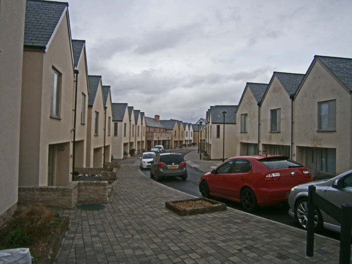
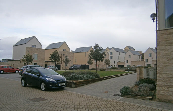
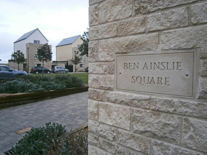
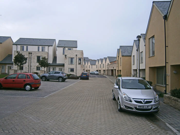
![]() Return To Top Of Page Return To Top Of Page
THE STRANGERS’ CEMETERY []
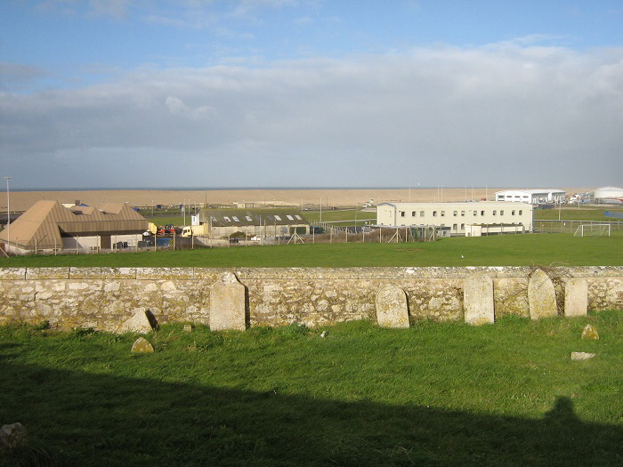
The "Strangers' Cemetery" is by the road above Chiswell. Burying the dead on Portland well illustrates the animosity between Tophillers and Underhillers and between Portlanders and others (Kimberlins or Strangers). The dead of Tophill were always buried on Tophill, Underhillers in Underhill cemeteries and the rest here, in the Strangers' Cemetery

This animosity still exists amongst the older Portlanders but is rapidly dying out as the Portland-born residents are becoming rapidly diluted by incomers from the Mainland.
Tophill (Easton, Weston, Southwell) residents were old traditional quarry workers, sheep farmers and growers of arable crops. Underhillers (Fortuneswell) were mainly Victorian immigrants who came to serve the Royal Navy and the Prisons. The fishermen living at Chiswell were separate again.
However, jointly, their hatred of Weymouth folk is legendary. In 1989 I was examining headstones in St George's Churchyard. An elderly man asked me if I was local.
"Yes, I've lived in Weymouth for over thirty years"
He spat on the ground.
"That's not local! Let me show you something"
He led me to a gravestone. The inscription reads
|
Sacred to the memory of Mary, daughter of John and Mary Way who was Shot by some of the Press Gang on the 2nd April 1803 and died of the wound the 21st May the same year.
Aged 21 years
|
|
In all, four Portlanders died repelling an attack by a Press Gang organised and encouraged by the Mayor of Weymouth. The old Portlander walked slowly away shaking his head. Even today there is animosity between the inhabitants of the ‘Portland Villages’.
I overhead a conversation by two inhabitants of Easton discussing the behaviour of a resident of Weston.
“It’s no more than expected from a Westonite!” opined one of the ladies.
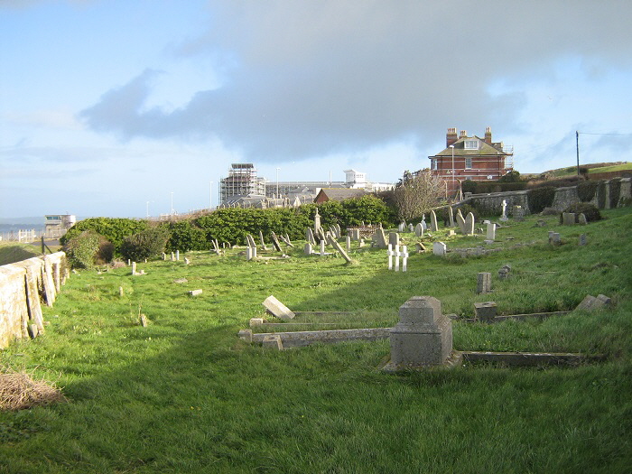

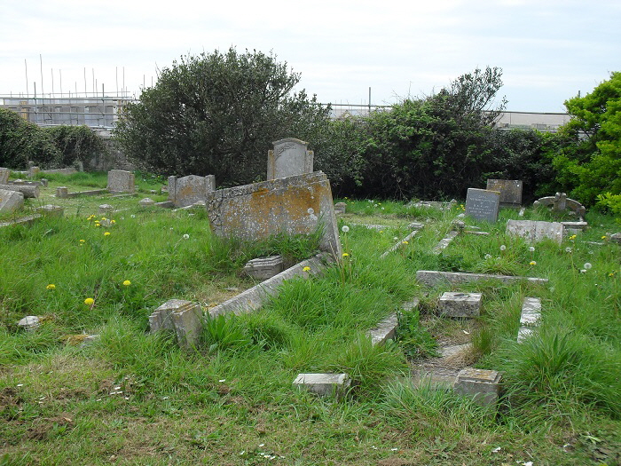
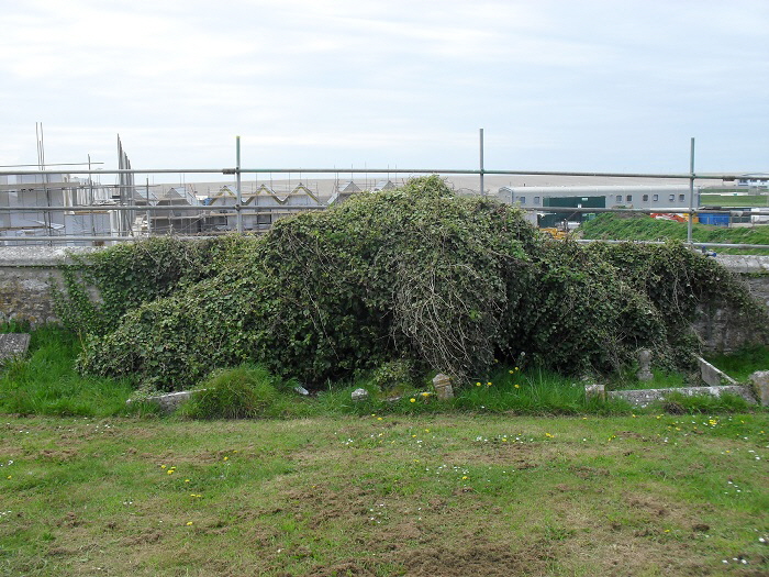
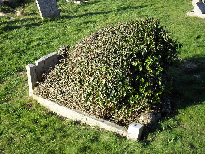
It is curious that many of the graves have subsided so that they tilt sharply towards the south.
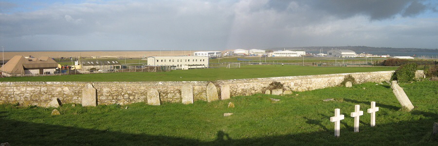
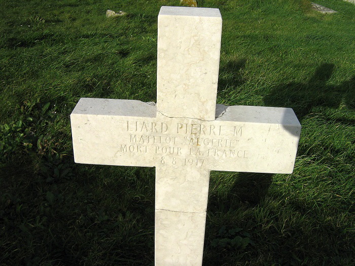
Three graves stand in a group marking the final resting places of three French sailors
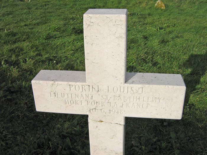
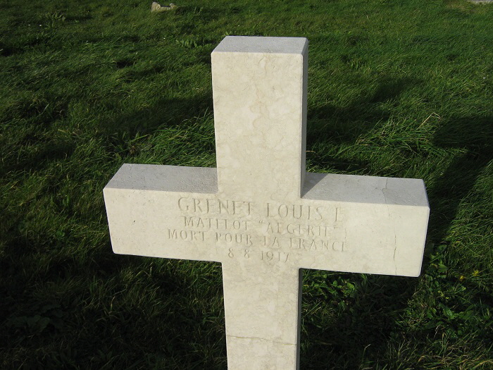
![]() Return To Top Of Page Return To Top Of Page
OUTLOOKS CENTRE []
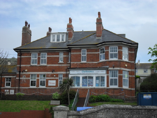
In the days when the Royal Navy was situated in Portland this was known as the Captain’s House. It is now an Outlooks Centre - see here for more details.
OLD POLICE STATION []

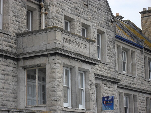
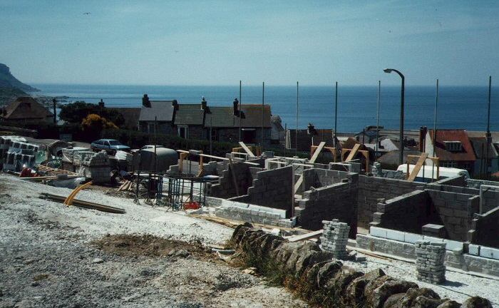
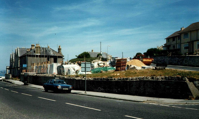
In the 1990s the police station was converted to private housing and adjacent land was developed for new housing alongside the old police station in Fortuneswell, 1989.
![]() Return To Top Of Page Return To Top Of Page
HIGHER LANE []

![]() Return To Top Of Page Return To Top Of Page
CLEMENT’S LANE []
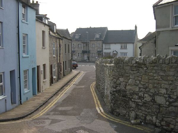
Above is the Chiswell end of Clements Lane.
![]() Return To Top Of Page Return To Top Of Page
QUEEN’S ROAD []
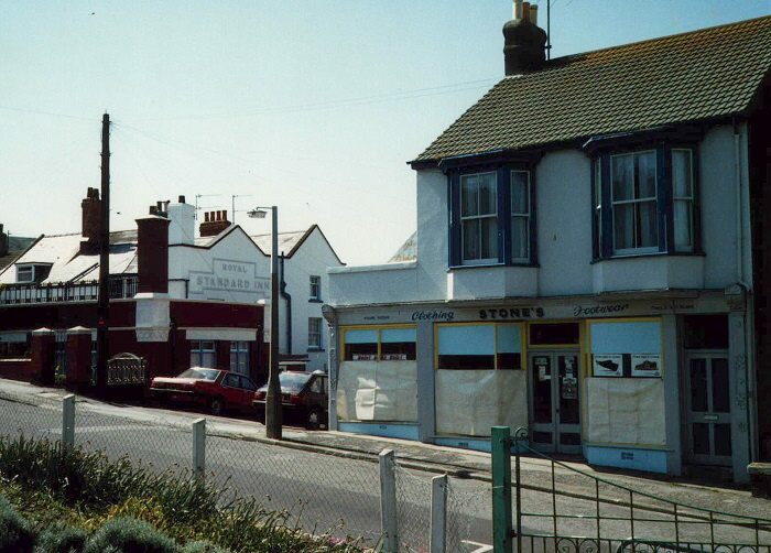
Stone's shoe shop in Queen's Road - shut for the last time in 1989. Sadly, few old-fashioned specialised shops like this have survived. In January 2003 work was underway to turn this building into a house and by 2007 it had lost all signs of ever having been a shop - see picture below.
ROYAL STANDARD PUB
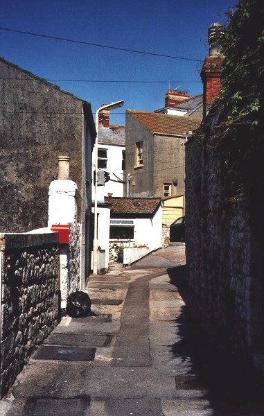
The upper end of Clements Lane lies between the shoe shop and the Royal Standard pub seen in this picture from February 2015.
![]() Return To Top Of Page Return To Top Of Page
ANOTHER OF MY HOBBIES

Age of 75 I started a new hobby - writing and publishing books. These are available as paperbacks from Amazon - please click here for details. Their overall star rating from readers is 
![]() Return To Top Of Page Return To Top Of Page
Keywords Chesil Chiswell Esplanade Cove House Inn storms January 2014 Brandy Row Free Portland News Portland Dorset
|