 |
Salt Pans, a Dead Whale and - a Mine! Portland, Dorset |
 |
|
Salt Pans, a Dead Whale and - a Mine! Portland, Dorset |
|
Back to Portland Home Page |
Back to Portland Map Index page |
|||
| MOVE | ||||
| All the pictures on this page showing a thick border are thumbnails. Clicking on the picture will produce a larger version. Use your browser BACK button to return to this page. | |
The above image is copyright Dorset County Council 2000 and is reproduced here with permission. |
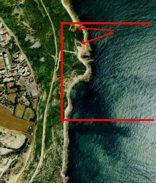
This small area of the extreme eastern coastline of Portland contains two ancient salt pans which are close to the top left-hand corner of the red square as marked with arrows. Please click here for a detailed street map. Click the BACK button on your browser to return to this page. Please click here to visit the satellite image of this area on Google Maps. Click the BACK button on your browser to return to this page.
|
|
ANCIENT SALT PANS
|
|
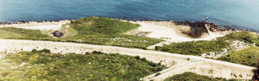
A panoramic view of this area showing the two ancient salt pans - the dark areas. These used to flood at Spring Tides and dry out during the following two weeks leaving an encrustation of salt. The white track across this picture is the line of the abandoned Weymouth - Easton railway. The sewer ventilator (see below) is on the extreme right of this picture. |
|
|
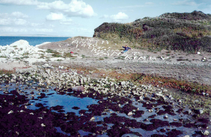
One of the two ancient salt pans. Some believe these were created by the Romans but the available evidence suggest they are medieval. Water would wash into these ponds at high tides and then the salt would be scraped off the rocks as the sea subsided and the wet rocks dried. This area is a favourite for spelling out messages in rocks. These messages can be seen from the roadway high above behind the YOI. |
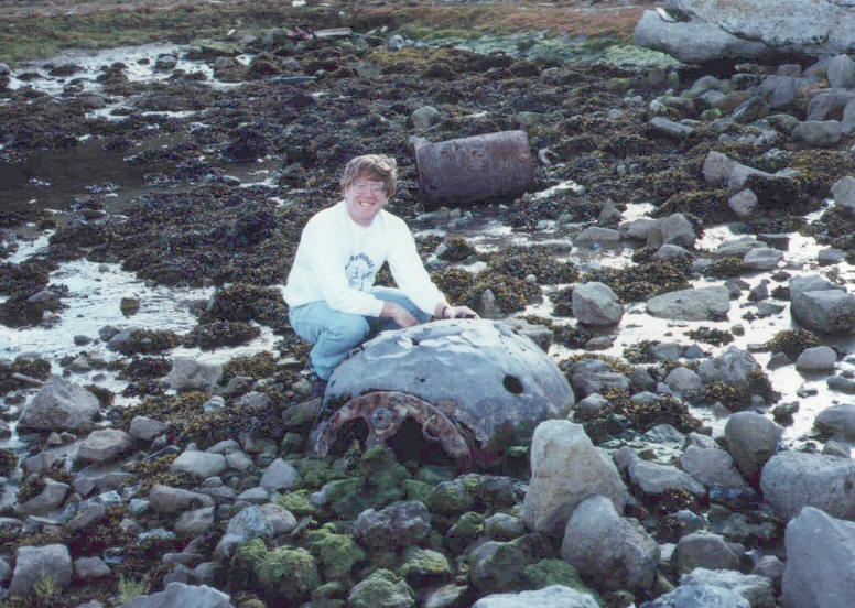
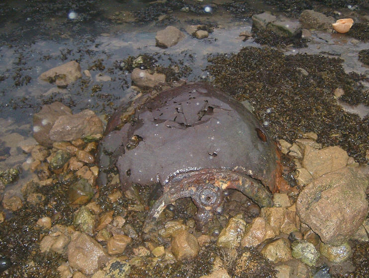
| AN ANCIENT SEA MINE | |
|
1990 |
2005 |
| For decades an old empty naval mine has lain rusting in one of the ponds. | |
|
A DEAD WHALE |
|
|
|
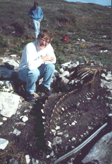
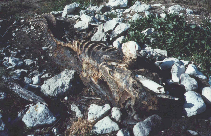
In 1989 a whale was washed up in the area of the salt pans. This soon decayed and an unsuccessful attempt was made to burn the corpse by persons unknown. This unfortunate creature was about 15 ft long. |
|
This picture appears to show the remains of a tusk - so, was this a whale or some other sea mammal? |
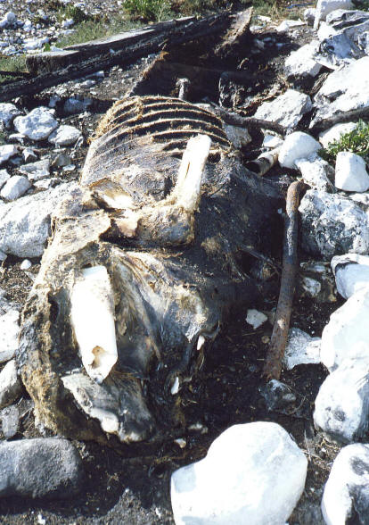 |
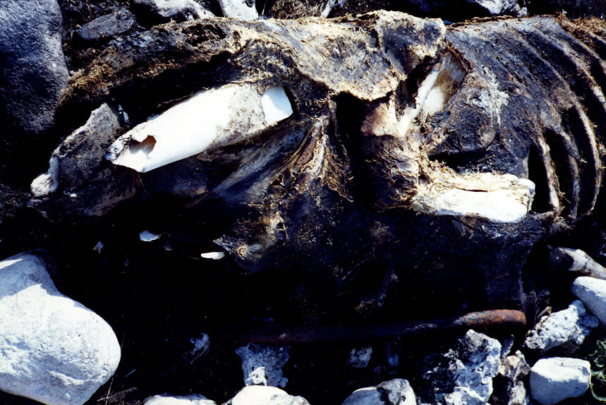
Here are three more pictures showing what appear to be tusks. Was this a Narwhale? |
| A SEWER VENTILATOR | |
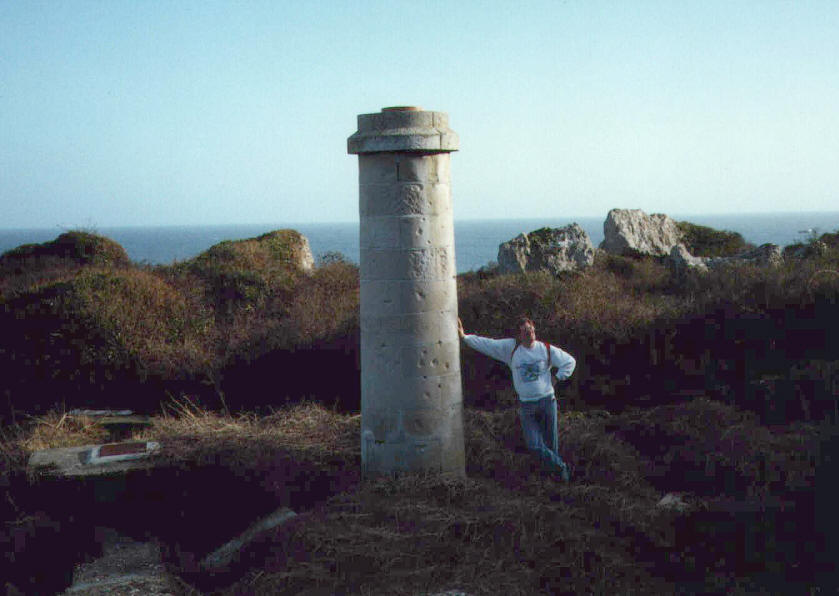 |
A Victorian sewer ventilator.
Now unused, it is a Scheduled Monument and a great device for leaning against! |
|
KIMMERIDGE CLAY OUTCROP |
|

|
A view showing the disused railway track and the soft Kimmeridge Clay stratum at sea level. The massive rock of Portland sits on soft oozing clay which can best be seen here at near Chesil on the west of the Island where the deepest strata reach sea level as part of the Weymouth Anticline. |
Back to Portland Home Page |
Back to Portland Map Index page |
|||
| MOVE | ||||