|

Tout Quarry Sculpture Park And West Weares
|
|
|
© OpenStreetMap contributors - see http://www.openstreetmap.org/copyright
|
|
The abandoned Tout Quarry stands at the north-west corner of Tophill and is situated between the cliff edge and the road to Weston and Portland Bill. It is now a sculpture park and is used to display an amazing collection of carvings and artefacts.
Also on this website page are the cliffs of West Weares where these skirt around Tout Quarry and the path at the foot of the cliffs which goes to an area known locally as the “Green Hump”.
Please click here for a detailed map. Click the BACK button on your browser to return to this page. Please click here to visit the satellite image of this area on Google Maps. Click the BACK button on your browser to return to this page. Please click here to see a large scale Victorian map of this area.
A map of Tout Quarry with identifications of fifty-four carvings can be downloaded and printed from here.
We start our exploration of this fascinating part of Portland at the hairpin bend in the main road between Underhill and Tophill. This is marked by a large old crane which has been reconstructed here to remind visitors of the historical importance of the trade in Portland stone.
We then walk along the cliff-edge to where this is blocked by a cliff fall. The South-West Coastal Path is then diverted into Tout Sculpture Park. After an exploration of this Site of Special Scientific Interest (SSSI) and its fascinating sculptures we emerge onto the coastal path again and head a little way south. The continuation of the South-West Coastal Path southwards can be followed by clicking here.
The sketch map below shows the pathways that can be explored in this area. Some are unsuitable for people with mobility issues. Numbers in square brackets on this web page like this [5] refer to locations on the sketch map below.
|
Please use this table to navigate around this page
|
|
RECONSTRUCTED QUARRY CRANE [1]
|

|
|
THE SOUTH-WEST COASTAL PATH AND WEST WEARES
|

|
|
LICHEN ROCK [2]
|

|
|
STONE SEAT [3]
|

|
|
TOUT QUARRY TRAMWAY [8]
|

|
|
ONGOING CLIFF FALL [4]
|

|
|
HALLELUJAH BAY [5]
|

|
|
THE GREEN HUMP [6]
|

|
|
TOUT SCULPTURE QUARRY
|

|
|
LANO BRIDGE [22]
|

|
|
TWO MYSTERY HOLES [30]
|

|
|
ANCIENT GLEBE STONES [31]
|

|
|
NORTH OF TOUT
|

|
|
WORLD WAR 2 RADIO STATION [24]
|

|
|
TRAMWAY TUNNEL [25]
|

|
|
THE “CIRCLE OF STONE” [27]
|

|
|
THE “MEMORY STONES” [28]
|

|
|
ANOTHER OF MY HOBBIES
|

|
|
RECONSTRUCTED CRANE [1]
A quarry crane has been preserved to stand near Priory Corner as a memorial to the local stone industry
The ironwork for this historic reconstruction was rescued from a crane which was standing in Suckthumb Quarry in the late 1980s; the last inland in-situ hand crane on Portland. Please click here to see this old crane.
The carved inscription has almost been weathered away. Why does such poor stone get used for carving inscriptions when the stones in St Georges graveyard show that stone can be carved and be legible for over a century? The above inscription is scarcely two decades old.
Similarly, the inscriptions on the Portland Millennium Gateway towers have all but gone due to erosion over a mere decade - please click here to see how the Portland Millennium Gateway engraving has decayed away.
Definitely not a good advertisement for the quality of Portland stone!
In April 2015 someone hung this birthday message on the crane. This area is very popular with wellwishers greeting their friends and family as seen by the typical examples below.
Return To Top Of Page
THE SOUTH-WEST COASTAL PATH AND WEST WEARES
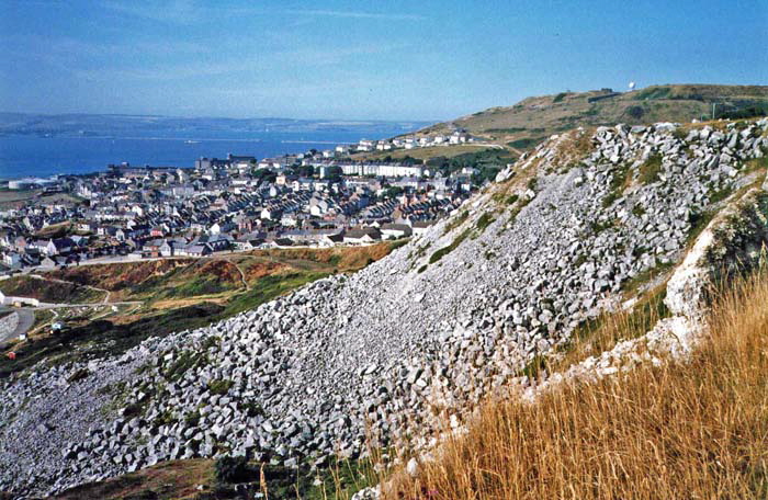
From the hairpin bend in the main road we can pick up the South-West Coastal path as it skirts the cliff edge heading broadly south.
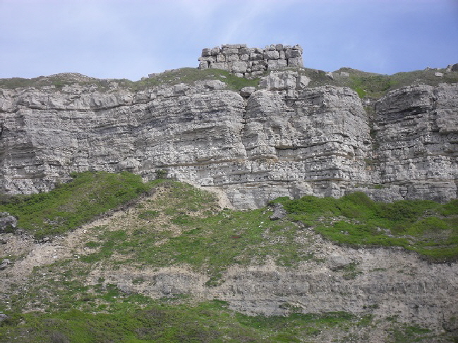
Above we see old quarry spoil tipped over the cliff from Tout Quarry above Fortuneswell. ‘Tout’ is old English for a 'look out'.
I estimate that over 20 million tonnes of rock have been pushed over the cliffs of Portland. This is five times as much rock as was moved to build the Portland Breakwaters which can just be glimpsed in the distance beyond Fortuneswell.
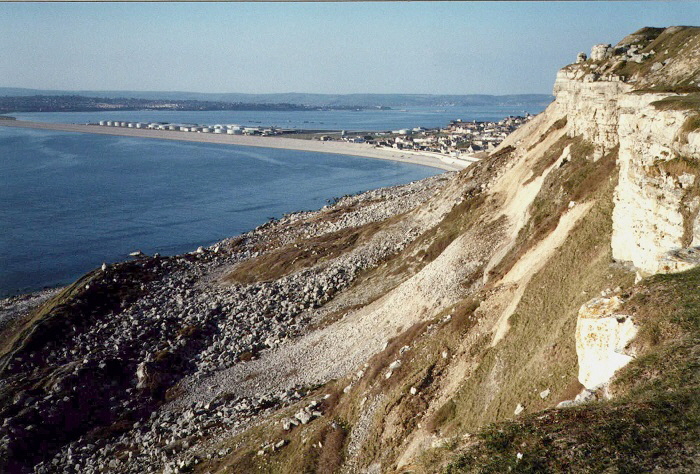
Above is another view of the man-made scree slopes. It is difficult to imagine how much toil by men and horses was used to create these huge slopes. On the left-hand edge of this picture we see the “Green Hump” which will be explored below - please click here
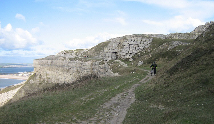
Another view of the South-West Coastal path where it passes along the spectacular cliffs of West Weares. There is only one bridleway (Watery Lane) on Portland - so it is surprising that there are so many riding stables. This also means that cycling is not strictly legal on the network of footpaths. However, my best friend Sandra need hardly worry as cycling and horse riding are tolerated and encouraged as a healthy way of exploring Portland.
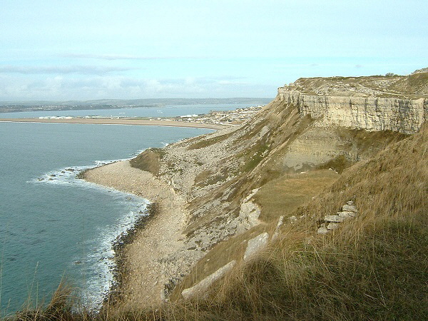
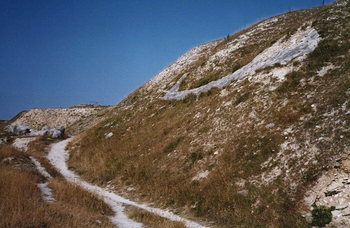
The South-West Coast Path and the scree slopes reaching down to the sea.
The picture below was taken about 100 years ago from this same point.
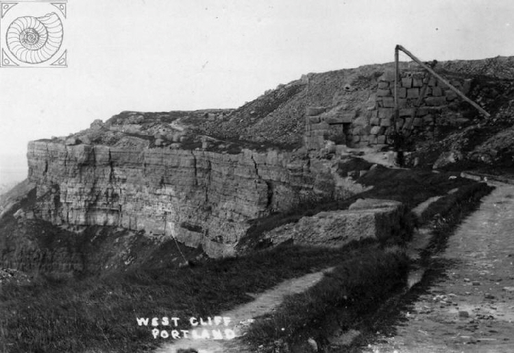
![]() Return To Top Of Page Return To Top Of Page
LICHEN ROCK [2]
This boulder stands near Tout Quarry on the edge of the cliffs. It has the distinction of having on its surface an example of every type of lichen that can be found on Portland.
Return To Top Of Page
STONE SEAT [3]
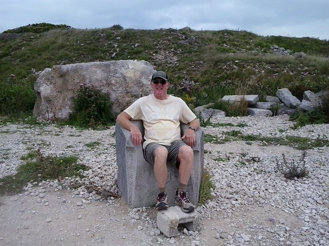
Overlooking the sea at West Weares is a stone seat upon which I sit and gaze out to sea in my exploration of Portland.
This seat was once smashed up by vandals using sledgehammers but has been repaired.
As I have remarked elsewhere on this website, Portland has more than its fair share of well organised vandalism. It’s not a case of simply scrawling graffiti. Portland’s vandals use seriously large equipment to do their damage.
Return To Top Of Page
TOUT TRAMWAY [8]
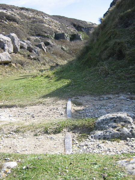
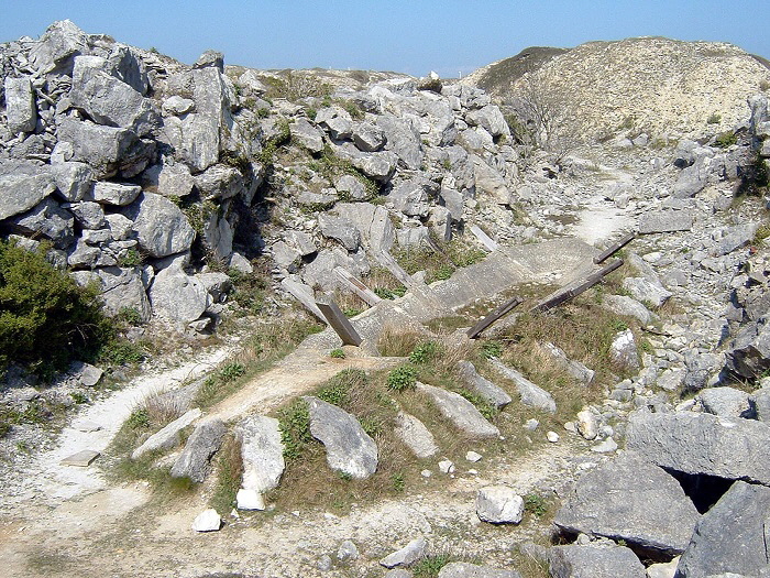
There are numerous narrow ravines leading from Tour Quarry to the cliff edge. Tramway lines used to run down these man-made valleys taking stone waste to the be dumped over the cliff or taking block stone to Priory Corner to be transported by the Merchants' Railway to the waiting ships at Castletown. A piece of rail can still be seen crossing the cliff edge path heading for the cliff edge. [7]
The track of stones upon which the tramway rails were laid into Tout Quarry. [8]
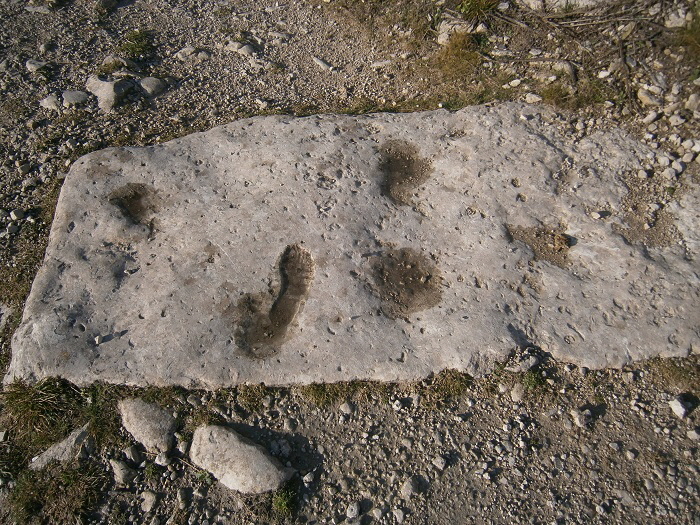
A close up of one of the tramway sleeper stones in Tout Quarry [9]. The imprint near the middle of this picture looks remarkably like a human boot print and yet this is Portland stone and not concrete where someone might have placed their foot whilst the mixture was wet.
Just a freaky random shape in the rock or a sculptor’s joke?
Return To Top Of Page
ONGOING CLIFF FALL [4]
The cliff edge between the main road and Blacknor Fort has been subject to erosion and collapse for centuries. In living memory there have been several large collapses of the cliff resulting in the loss of the cliff edge path.
This picture shows a huge slab of rock which has very slowly been sliding down to the sea since at least the 1960s when I first saw it.
The most recent at the time of writing has been a slow slide of huge volume of rock which resulted in the severing of the path and the need to divert the South-West Coastal Path on a long inland diversion.
Cracks appeared in about 2014 and these widened making the path increasingly difficult to walk. Then in the autumn of 2015 a huge section of cliff started to tilt outwards and to slide towards the sea.
At the time of writing (March 2018) this slide is still slowly underway despite predictions over the past year that the whole area would fall away in a single spectacular collapse.
In fact a section of cliff did fall away and was caught on camera in a spectacular movie which can be seen here. However, this was only a relatively small section of the collapsing cliff.
This picture from September 2015 shows the cliff edge starting to slump and slide towards the sea. At this time it was still possible to walk the coastal path with the need to scramble over the increasingly high ‘step’ in the path. Over the following year the slump continued and the path was eventually severed by the opening of a crevasse as shown below.
I have been visiting this widening crack for eighteen months during which time the massive slab has been slowly sliding towards the sea.
The following three pictures were taken in September 2016 and show the precarious state of the cliffs.
Will this huge slab of Portland Stone still be sliding slowly down to the sea at the end of 2016 or will it fall in a spectacular fashion?
From this location we can look down and see a path extending southwards from the end of Chesil Esplanade. This bay is known as Hallelujah Bay.
This bay and the pathway will be described next after which we will return our attention to the cliff top path and Tout Quarry.
![]() Return To Top Of Page Return To Top Of Page
HALLELUJAH BAY [5]
This area is known as Hallelujah Bay (or variants of that spelling) - please click here for details of this area and how it got its name.
This path was cleared almost single-handedly by Hiram Otter, one of Portland’s many eccentrics.
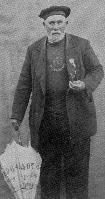
Hiram Otter (1833 - 1915) with his umbrella painted with religious slogans.
Hiram Otter is third from left in the back row in this picture from 1900. Beards were all the rage in those long past days. He would carve biblical inscriptions and first lines of hymns onto the boulders and would then cry "Alleluia!" when each text was completed.
About ten years ago I discovered the above faint lettering on a rock in the area. It is said that none of Hiram Otter’s carved texts have survived but - could this be one? Is that partial misspelt word part of Jesu Joy Of Man’s Desiring?
The sun was at a fairly high angle so I determined to return when the sun would be at a glancing angle and show up the faint letters better. So a few weeks later I returned and found this!
Oh well - now I will never know whether Hiram Otter’s last surviving religious text existed at this spot.
In 2016 the mystery of this rock carving deepened when I discovered that Naomi’s name had been deleted and a retrospective date had been added.
The following pictures show the rough terrain through which Hiram Otter’s path passes. The cliffs of West Weares tower over the walker.
There is a bunny in this picture. Can you see it?
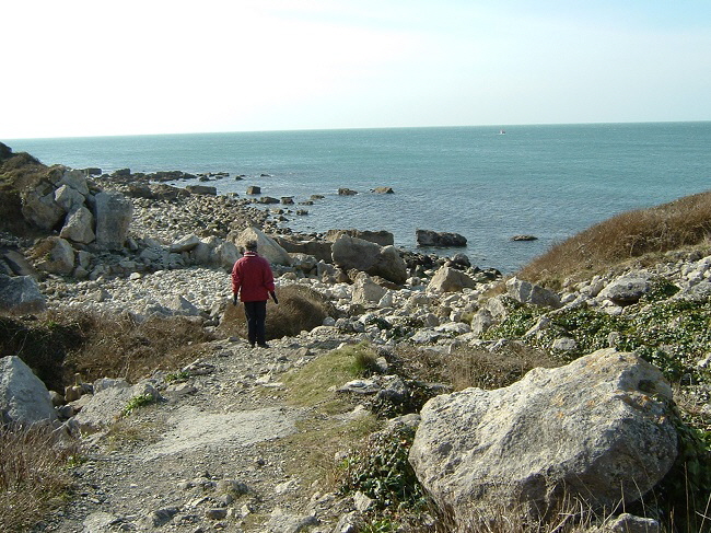
Twenty years ago the path went where my best friend Sandy is standing but it has long been diverted by landslides.
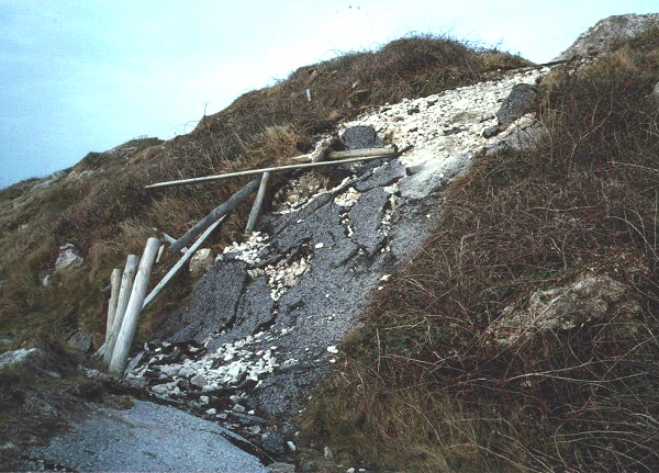
This picture shows how a tarmac section of this path became nearly vertical in 1990 as a result of a large landslip in the unstable scree slopes.
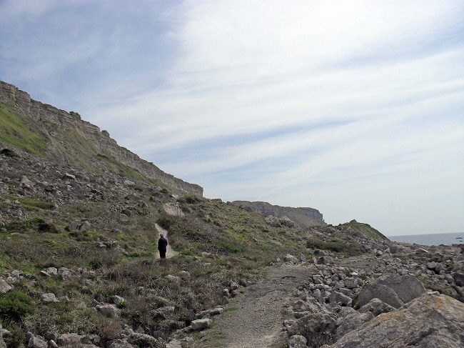
The diverted path is to the left of the broken path in this picture.
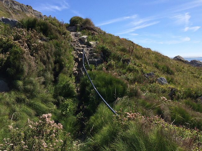
This was once a flight of steps with a handrail. Recent landslides have made this impassable.
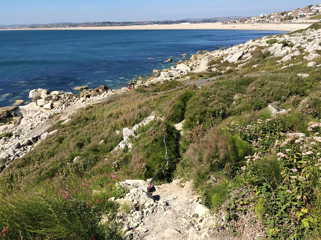
Most walkers will have given up by this point because of the dangerous and near-vertical climbs.
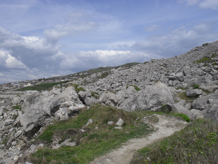
If you persist in following this path it comes, after a great deal of hand-over-hand scrambling to what is known locally as “The Green Hump”.
![]() Return To Top Of Page Return To Top Of Page
THE GREEN HUMP [6]
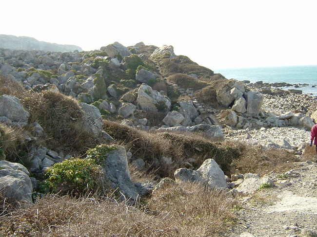
Beyond the “Green Hump” the foreshore is very difficult and dangerous to walk upon.
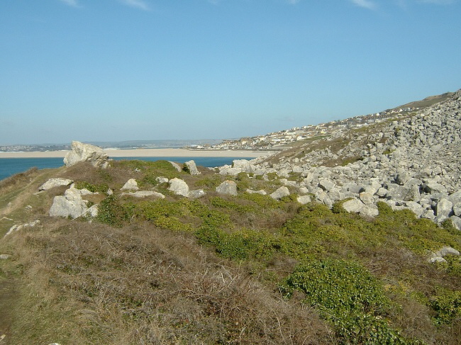
The ‘Green Hump’ looking back towards Chesil.
The southernmost point of the “Green Hump” shows the steeply inclined rock strata exposed by coastal erosion. The cliffs of Blacknor Point are in the background.
Having explored the sea level coastal path as far as the ‘Green Hump’ we now carry on with the exploration of the cliff top South-West Coastal Path and Tout Quarry.
![]() Return To Top Of Page Return To Top Of Page
TOUT QUARRY SCULPTURE PARK

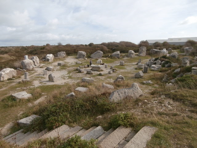
Overall View of Tout Quarry Sculpture Park.
There is an excellent article on the quarry here.
This imaginative use of an abandoned quarry started in 1983 and some of the early sculptures are pictured below. Alas very few of these early efforts survived for more than a year. I was fortunate to photograph them before they were lost to vandals.
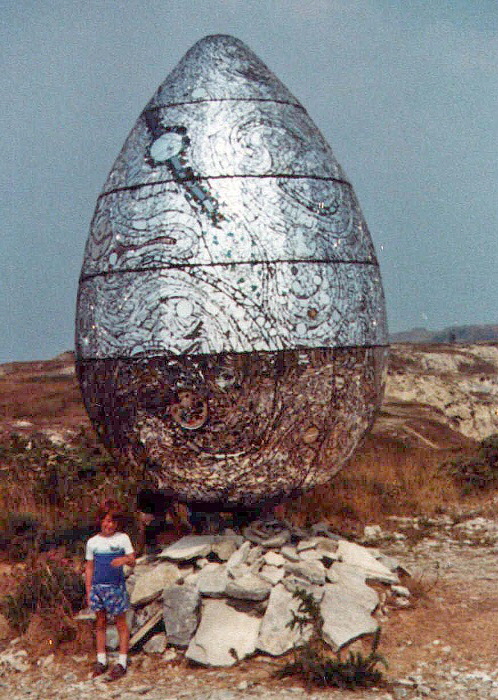
“THE COSMIC EGG”
Made by Andrew Logan this is a sculpture made of wood, resin and mirrored glass. This was a spectacular sight high on the northern ramparts of the quarry in the 1980s.
There is a movie of the Cosmic Egg being built here.
In September 2016 I thought that I might have discovered the remains of the base of this structure.
I noticed a strange circle on a Google Earth image of Tout located at [29] on the sketch map at the start of this page. I used a hand-held GPS tracker to guide me there. Unfortunately, this circle was located on top of a mound of quarry debris only attainable by a near vertical and slippery rock face.
What I found was a circular area of stones which was much overgrown and could well have been the abandoned base of a long forgotten sculpture as seen below.
Curiously this circle of stones does not appear on any of the Dorset County County aerial survey photographs taken between 2002 and 2013.
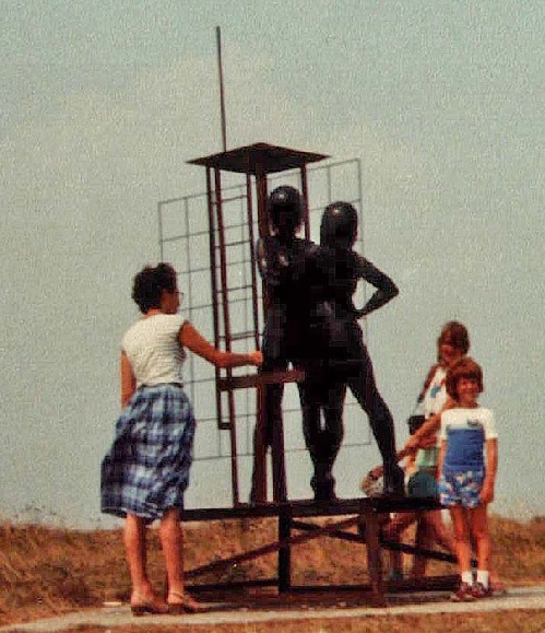
A metal sculpture of two lifelike human figures. This had been vandalised and removed by the end of the first year on display in 1983.
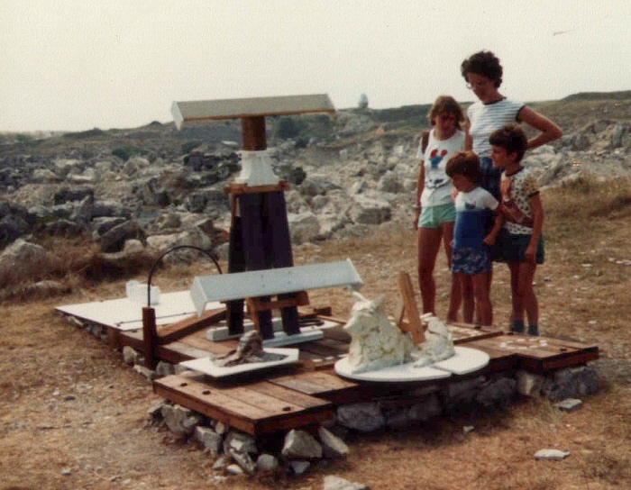
A creation from 1983 which survived only for a few months.
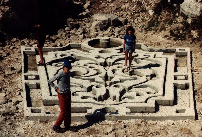
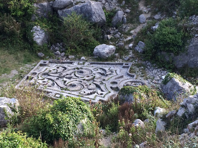
The Persian or Baroque Garden pictured in 1984 [10]
An elaborate design in stone and concrete pictured above in 1989. This survived for many years and is shown below still relatively intact in September 2016.
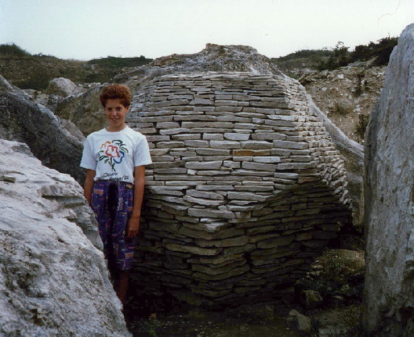
“Philosopher's Stone” by Robert Harding
Photographed in 1990, this structure is still intact - I suspect because it is partially hidden behind large boulders [11]
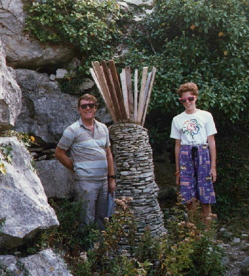
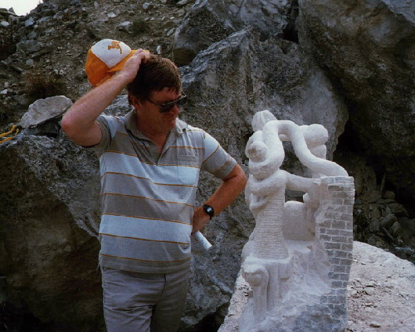
Above and below are two sculptures from the 1980s which did not survive long.
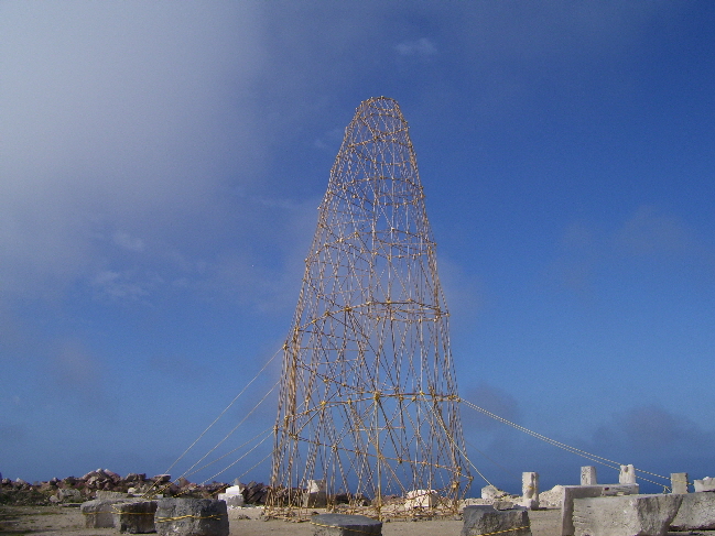
The “Bamboo Screw” - picture by Alan Coman.
Below we see a sculpture “Stone of the Summer Solstice” by Roger Davies as it appeared in 2016. [12]
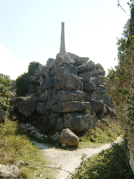
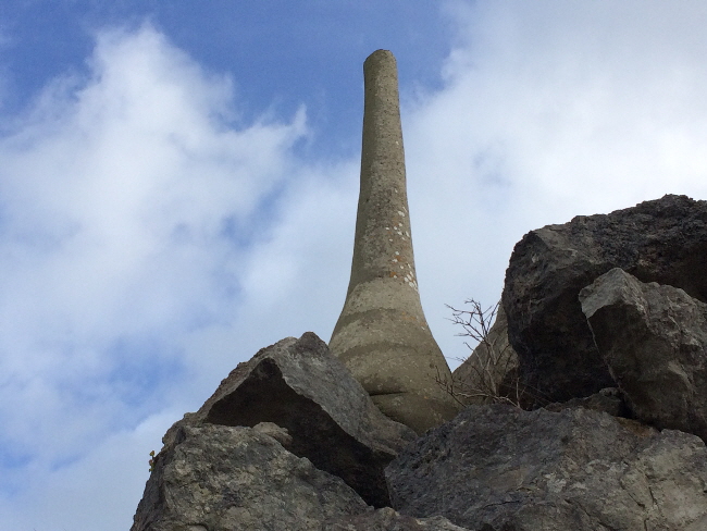
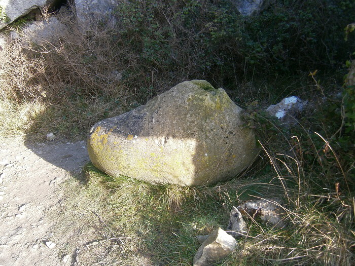
The four pictures below show the sculpture as originally created in the 1980s. These pictures are copyright Angela Macdonald and are reproduced here with her kind permission.
Angela describes the sculpture in its original form as follows:
“The top of the pinnacle was topped with a pyramidal beaten lead cap which fitted into an inverted lead structure inserted into the "egg" which lays at the base. This in turn was surrounded by twelve graduated stone pillars which have disappeared.
The idea was that the sun's rays would cast a shadow onto one of the smaller pillars each month and at mid-summer the leaden structures would shadow and fit into one another.”
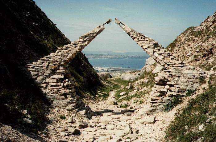
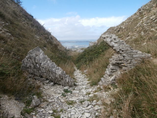
A dramatic view of Weymouth through an arch recorded in 1984. In 2016 was almost totally destroyed as seen below. [13]
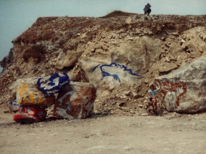
The art of rock painting - from 1983. An abstract sculpture stood on the hill but this has long since gone.
A stone helicopter (“Wessex” by Andrew Kirkby) was set into a pile of quarry waste overlooking Fortuneswell as pictured in 1990. Enough remained in 2003 to be able to make out the outline of this aircraft. Plans were put forward in 2008 to renew this feature but this never happened.
A shipwreck made from concrete and railway sleepers. [14]
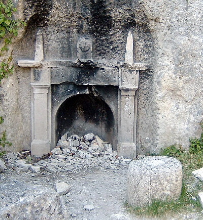
A superbly carved fireplace and seat and clock. Unfortunately, some fools have lit fires in the grate and damaged this masterpiece. [15]
Timothy Shutter, creator of "Hearth", commented in 1989: "The sculpture provides an incongruous corner of domestic comfort within the exposed setting of the quarry; the fire surround refers back to a time when the quarry was being actively worked, functioning as a memorial to the lives and skills of a generation of Portlanders."
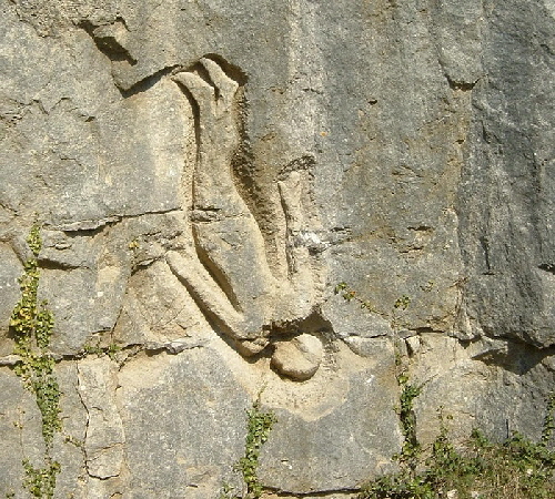
Antony Gormley was the first artist to work in the quarry in 1983, when he created the carving "Still Falling" [16].
This is a life-size figure incised into the rock face. The figure was purposely distanced from the viewer by the depth of the quarried space below.
Gormley commented in 1983: "The quarry itself is a powerful inspiration and tribute to the small bands of men that worked it, using blocks and wedges as well as natural layering and fissuring to cut the stone. Their technique (using neither complex machinery nor explosives) was a mixture of science, intuition and hard team work that is a model for us all... Working with stone is a fine job. Working on stone in a quarry is a challenge. You have to consider the material as a part of the place; as part of the earth."
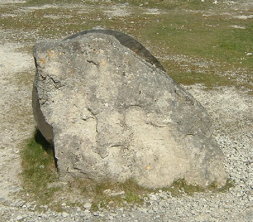
A block of rock with a circular saw blade embedded in it - symbolic of Portland's stone cutting industry [17]
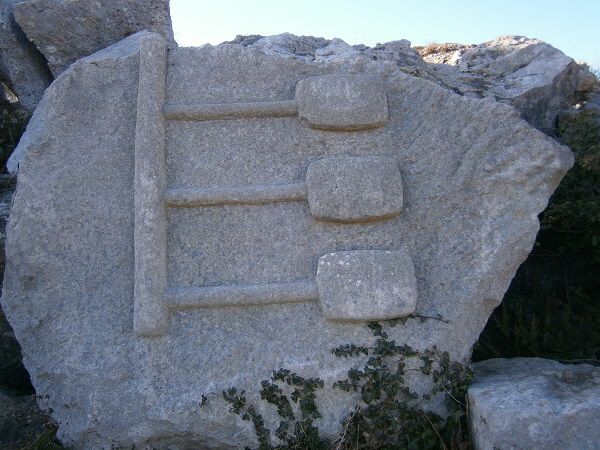
An abstract carving called “The Beauty of Surveillance” [18]
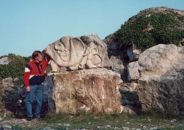
An early carving from 1983 [19]
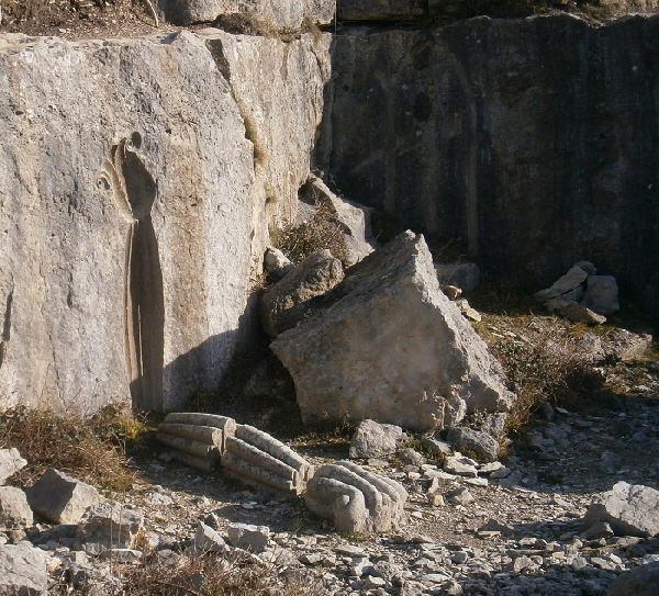
“Fallen Fossil” by Stephen Marsden [20]
Stephen Marsden, creator of the "Fallen Fossil" carving, commented in 1985: "The piece resembles a fossil only vaguely, it is more a symbolic architectural statement which implies a positive column form with flower-like capital having originated from a wall or face of living stone. The positive image lies on the ground in three fragments. In the light in which the two elements, vertical and horizontal, share a partnership, the grounded and fragmented column might be seen as the more passive element, the vertical more assertive."
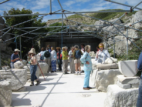
An area where stone carving is taught and practised [21]. Please click here for more details of stone carving lessons at Tout Quarry.
In 2016 a local and talented sculptor added a new carving in Tout Quarry and was promptly threatened with a fine of £20,000. This is because most of the quarry is now designated a Site of Special Scientific Interest (SSSI) and is protected by law from any alteration.
Fortunately common sense prevailed and the sculptor was allowed to carve outside the SSSI.
Return To Top Of Page
LANO’S BRIDGE
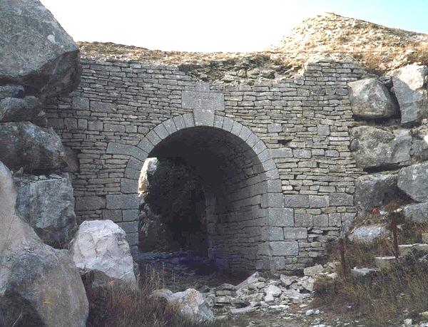
Lano's Bridge [22] was built in the mid-1800s to carry a high level tramway taking stone spoil to the cliff edge with a low level tramway going through the arch taking stone to the Merchants' Railway.
In the late 1980s well equipped and determined vandals attempted to demolish this old bridge and almost reached the keystone as seen above.
Following an appeal for old photographs of the bridge, it was carefully reconstructed with each stone put back in its original place. The above picture shows the bridge after this attack and during reconstruction
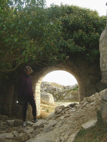
Then in October 2003 another attempt was made to damage the old bridge - this time by loosening stones to the north in the ravine.
Vandalism on Portland is often a well organised activity with tools and even machinery being used to damage and destroy artefacts. Some of this has been carried out by the stone firms who have, over decades, deliberately destroyed features of great historical and geological value such as the wanton destruction of Withies Wall, click here for details. Also the proposed destruction of one of Portland’s mediaeval windmills, click here for details.
A section of tramway rail embedded in solid stone near Lano’s Bridge. Was the removal of this rail a test of strength amongst quarrymen?
![]() Return To Top Of Page Return To Top Of Page
TWO MYSTERY HOLES [30]
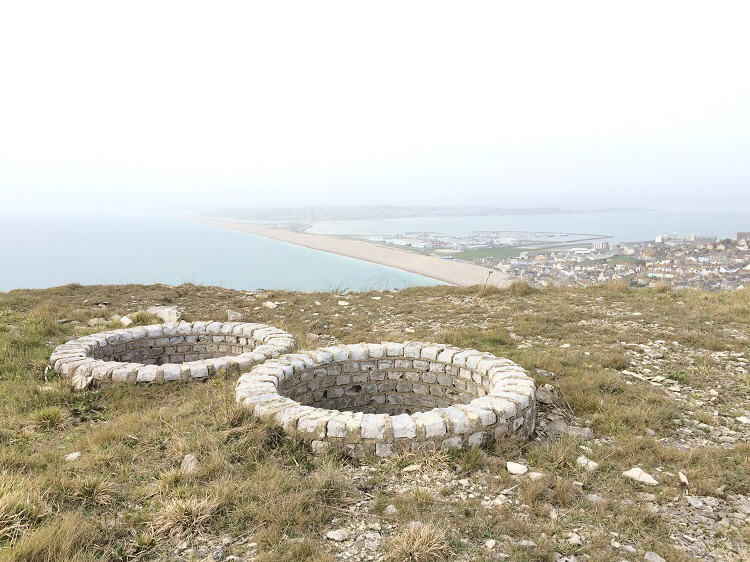
To the south-west of Lano’s Bridge high on a mound are two circular holes. These can be seen on the Google Maps view from space - please click here. They are about 1 metre deep by 1.3 metres diameter.
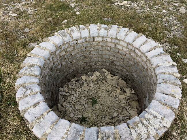
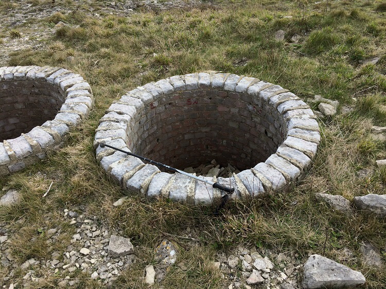
I have been unable to find out the purpose of these two holes.
There are two leading theories.
Firstly there were used in World War II as lookout or machine gun posts.
Secondly, that were in some way associated with the creation of the Tout Sculpture Park within which they are.
GLEBE STONES [31]
Within the shaded area adjacent to the number 31 on the sketch map at the top of this page are a number of ‘Glebe Stones’.
This map kindly provided by Alan Coman is from around the early 1800s. It has south at the top and shows an area marked as ‘Glebe’ which is in the area now worked for stone as Tout Quarry.
A line of stones is marked on this map.
The above old map shows the stones within the enclosed black lines.
The ‘Glebe’ was a parcel of land allocated to a Church of England clergyman from which he could derive an income to help run the parish and provide him with personal income - see here for more details.
The following pictures show the Glebe stones in their present setting on top of two adjacent mounds to the west of Lano’s Bridge.
Some of the stones have the word ‘GLEBE’ carved into a face, one has a letter ‘G’ and the others are worn too much to make out a marking.
Near the Glebe stones are the remains of a building believed to be associated with the creation of the Tout Sculpture Park in 1983.
AREA TO THE NORTH OF TOUT QUARRY
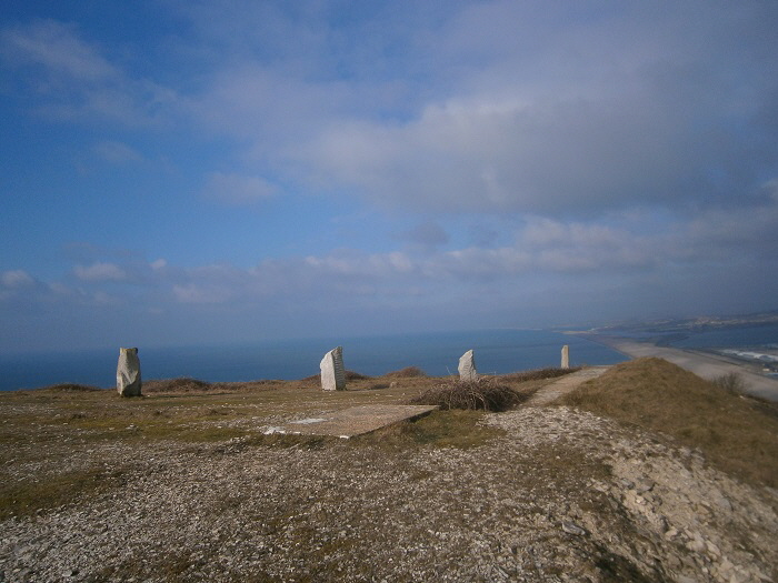
The northern part of Tout Quarry is high ground on which many sculptures were erected in the 1980s. However, only one structure now exists which is a line of standing stones aligned approximately towards Weymouth in the distance.
The standing stones photographed in the 1990s [23]
Sunset on the top of Tout Quarry.
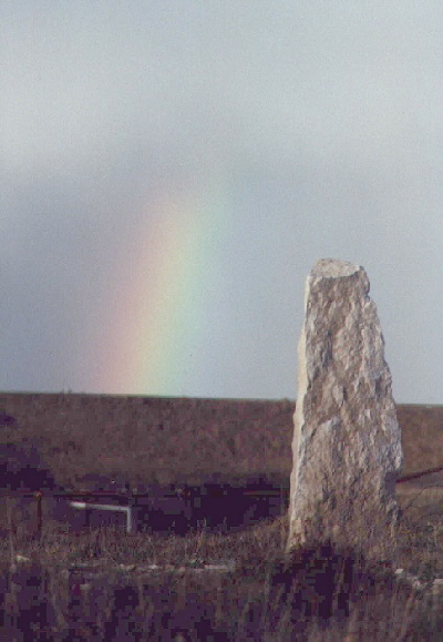
A rainbow gently kisses the earthen ramparts of The Verne Prison - but was there a crock of gold to be discovered by the prisoners?
The row of stones was still standing on the skyline in 2015.
![]() Return To Top Of Page Return To Top Of Page
THE WORLD WAR 2 RADIO STATION [24]
During World War 2 buildings and aerials were erected on this high point as part of the World War II Coastal Defence/Chain Home Low (CD/CHL) radar station. The station, named site M73, was constructed by the Army to monitor shipping and aircraft during the war - please click here for further details. There are still concrete steps leading to the summit and there are foundations of the buildings as shown below.
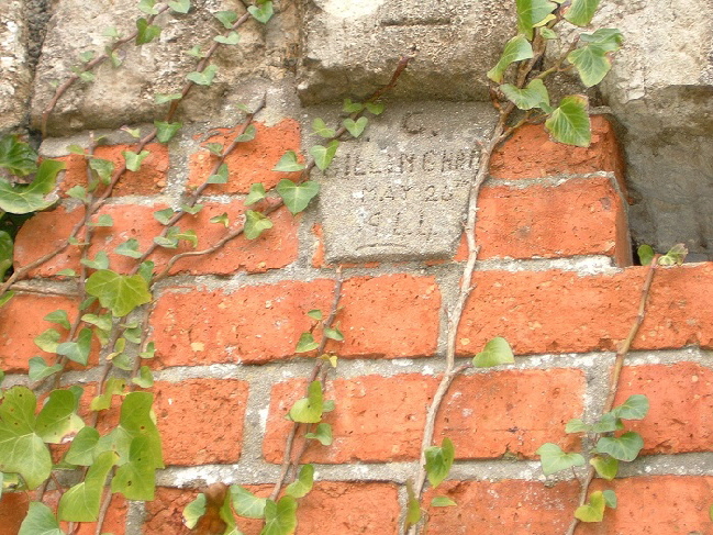
Nearby is the entrance of a Victorian tramway tunnel [25] which was bricked up in 1944. A stone existed as shown above mounted in the wartime brickwork. This read "E. C. Gillingham. May 26th 1944". Recently this brickwork was destroyed to enable the tunnel to be reopened for walkers.
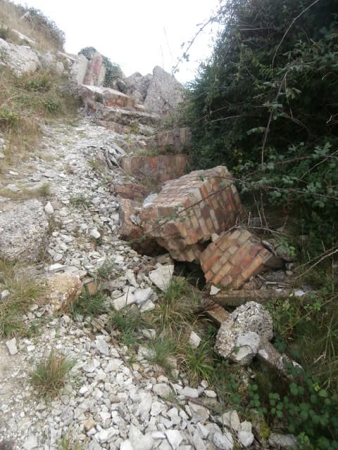
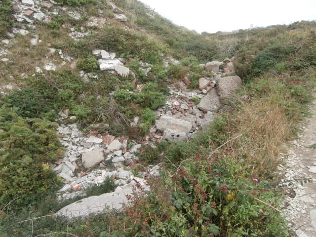
The wartime buildings were demolished and the rubble thrown into a nearby ravine as seen above in 2015.
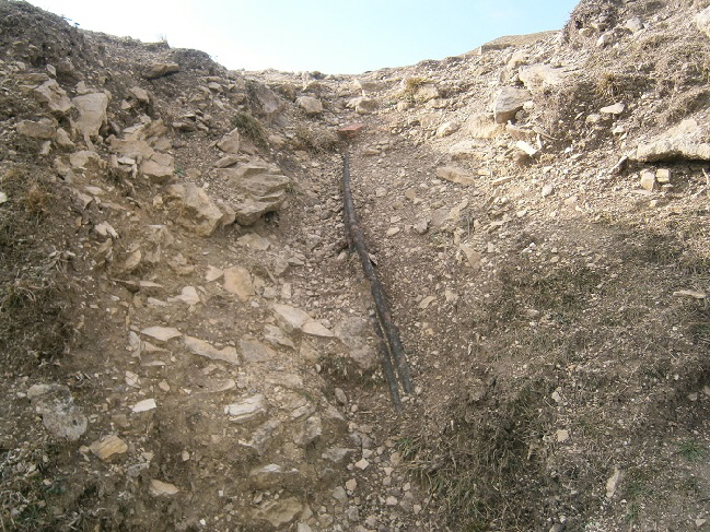
Cables which once supplied power to the military buildings above Tout Quarry.
![]() Return To Top Of Page Return To Top Of Page
REOPENING A TRAMWAY TUNNEL [25]
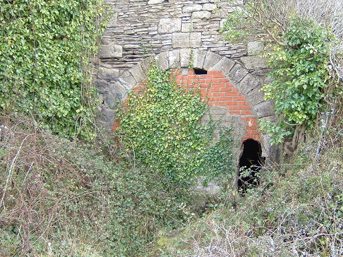
There were three tunnels passing from Tout Quarry to Inmosthay Quarry to the east. These passed under Wide Street. There were used by tramways to transport stone from Inmosthay into Tout Quarry and onwards to the West Cliff tramway which ran around to Priory Corner and the top of the Merchants’ Railway.
All three tunnels were blocked.
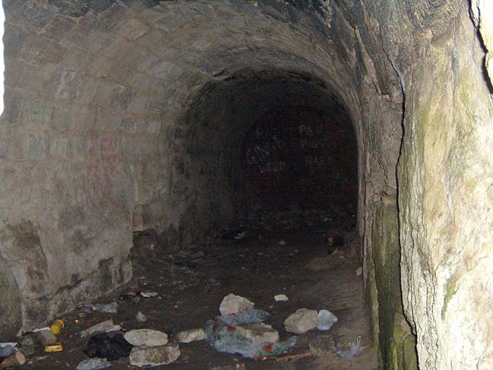
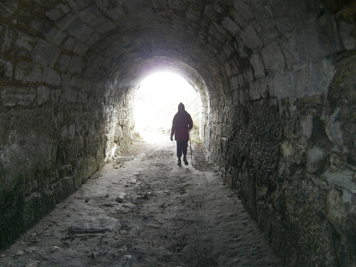
However, in 2003 the World War 2 brickwork blocking the main northernmost tunnel was smashed by vandals. This gave me the opportunity to get into the tunnel and take the picture below. Notice how the interior of the tunnel appeared to be constructed from carefully cut stones and no mortar.
In 2010 it was decided to unblock this tunnel to provide a pedestrian walkway under the main road.
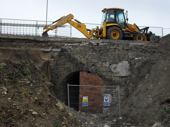
This involved demolishing the brick walls at each end and rebuilding the eastern entrance retaining wall to make the tunnel safe to use. The picture below shows the tunnel in use.
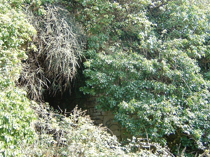
Below we see the heavily overgrown and blocked entrances to the other two tunnels from Tout Quarry.
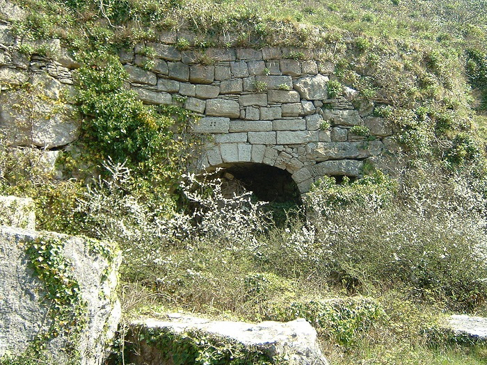
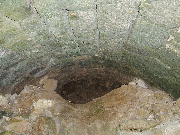
Inside one of the two remaining blocked tunnels [26]
![]() Return To Top Of Page Return To Top Of Page
“THE CIRCLE OF STONE” [27]
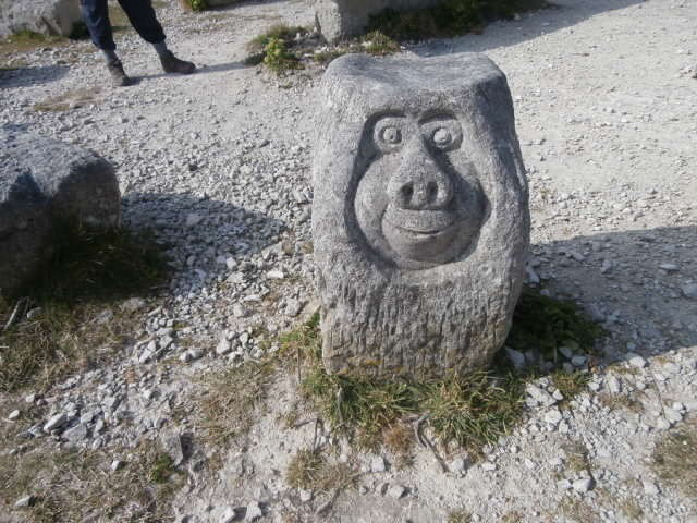
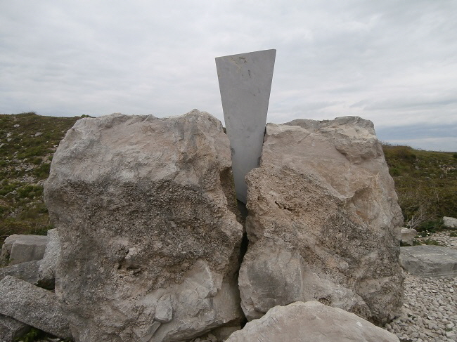
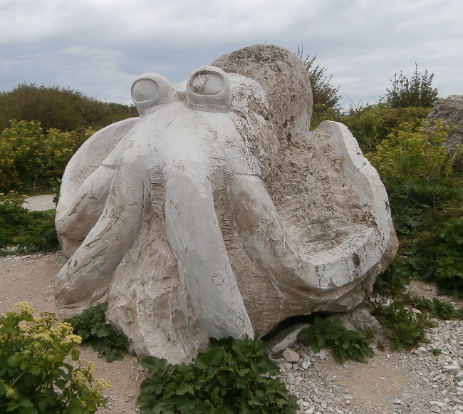
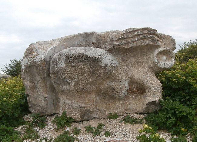
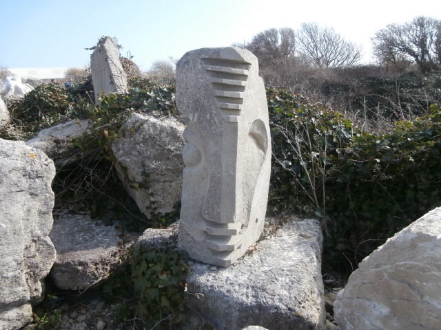
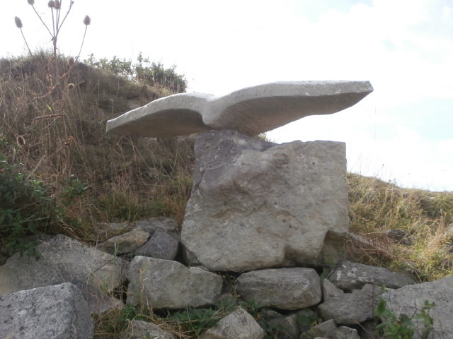
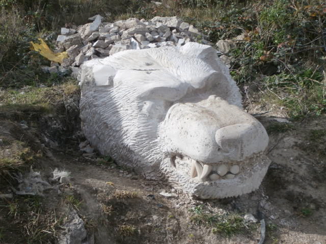
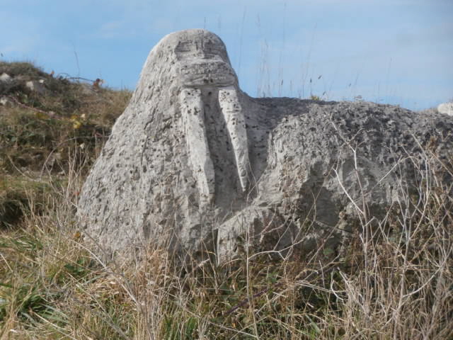
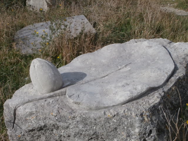
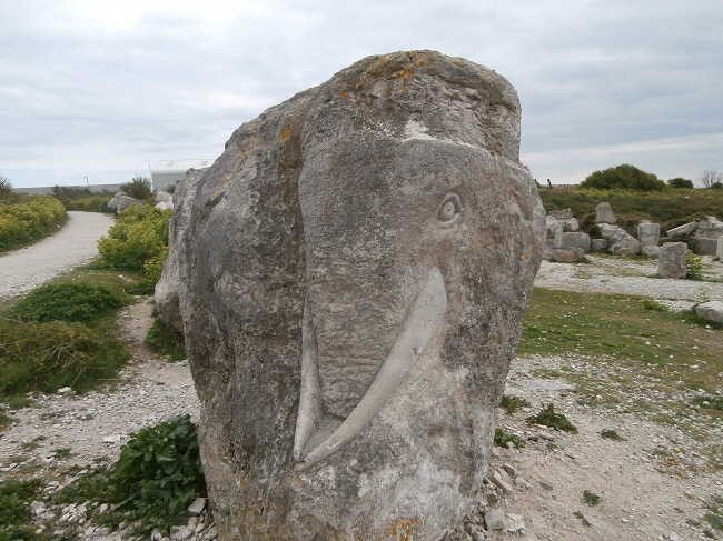
For several years a group of sculptors from the Netherlands have travelled to Tout each year to create carvings in an area set aside on the west side of Tout Quarry outside the SSSI.
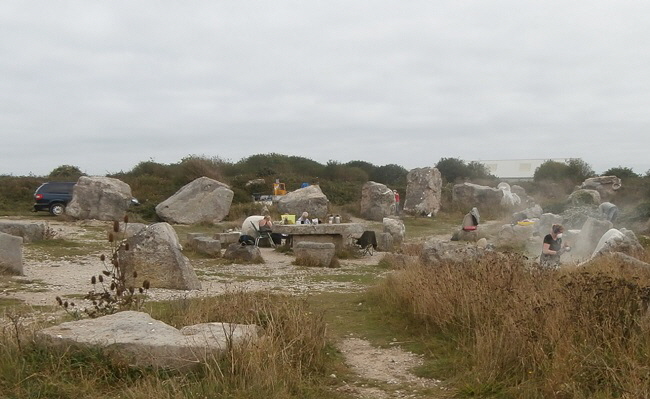
A group of Dutch sculptors at work during the summer of 2016
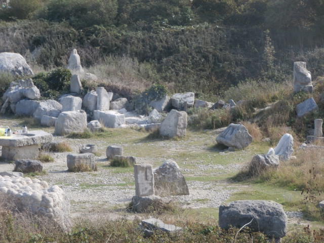
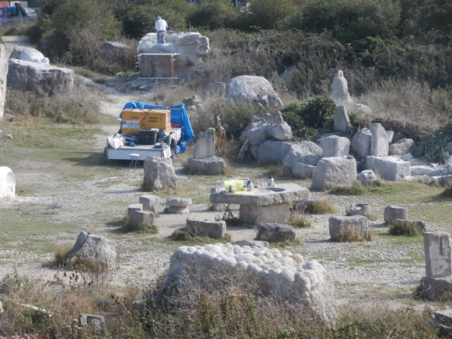
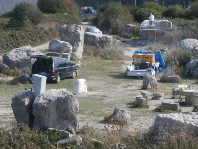
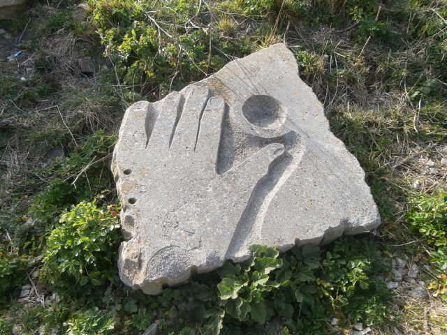
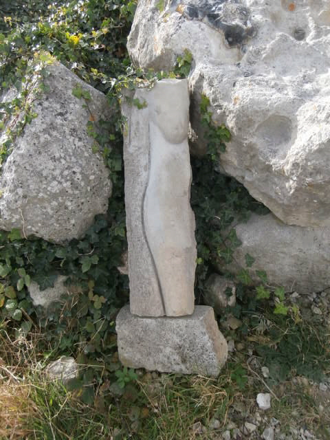
Half a woman
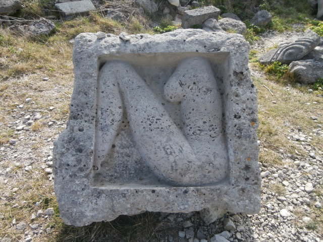
Another half of a woman.
Return To Top Of Page
MEMORY STONES [28]
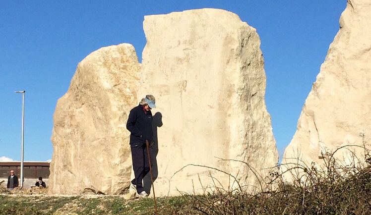
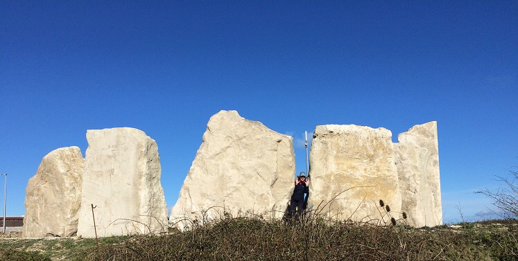
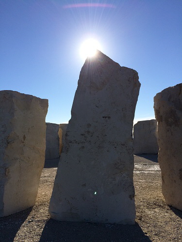
In 2017 a new stone feature was erected opposite the Portland Heights Hotel called the Memory Stones - click here for details of this project.
Created by artist Hannah Sofaer, the partial ring of large stones form an arc that mirrors the orbit of the Earth around the Sun.
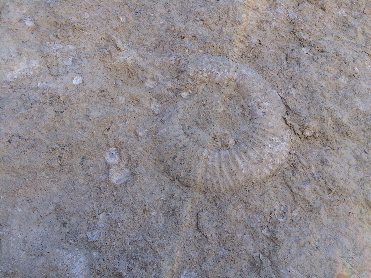
Hannah has said “The stones are aligned to the sunrises and sunsets of the summer and winter solstice and the spring and autumn equinox with shadows that span up to 90ft long in Midwinter. In the second stage of the project the stones will be letter-cut and core drilled for text to be projected into pools of light within the stones shadows, creating interpretation at different times of day. Each stone creates a vista to the ecology, geology, quarrying history, art and architecture across Portland’s landscape.”
ANOTHER OF MY HOBBIES

Age of 75 I started a new hobby - writing and publishing books. These are available as paperbacks from Amazon - please click here for details. Their overall star rating from readers is 
Keywords Tout Quarry Sculpture Park And Surrounding Area Portland Dorset
|